

Derrah Getter's First Warning Forecast
This evening will be pleasant and warm. Spotty showers pop up overnight but dry conditions return by daybreak. Temperatures out the door Monday morning will be in the low to mid 70s.

Monday afternoon will be mild with highs in the mid 80s. A few more isolated storms will be possible in the afternoon.

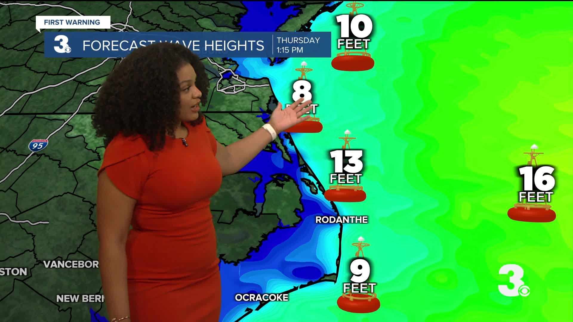
Hurricane Erin's path off the Atlantic coast will lead to dangerous beach conditions especially Wednesday and Thursday. There will be a high rip current risk all week long. Maximum wave heights between 10 and 12 feet are forecast.

Tropical storm force winds and heavy rain will be possible for portions of the Outer Banks and coastal flooding will likely make some roads impassible.

Atlantic Hurricane Season Update
Aside from Hurricane Erin, we have two other areas of interest in the tropics.
The first area lies off the Atlantic coast. Recent satellite derived winds indicate an elongated area of low pressure. Shower and storm activity appears to be limited. Development, if any, will be slow to occur.
Formation chance through 48 hours...LOW...10%
Formation chance through 7 days...LOW...10%
The second area we're watching is a tropical wave near the Cabo Verde Islands. Gradual development will be possible mid to late week.
Formation chance through 48 hours...LOW...near 0%
Formation chance through 7 days...LOW...30%

Let's connect on social media!
Forecaster Derrah Getter:
For weather updates on Facebook: HERE
For weather updates on X: HERE
Follow me on Instagram: HERE
Check out the Interactive Radar on WTKR.com: Interactive Radar
