


Meteorologist Myles Henderson’s First Warning Forecast
*** Extreme Heat Warning for most of SE VA and NE NC through 8 pm Wednesday.
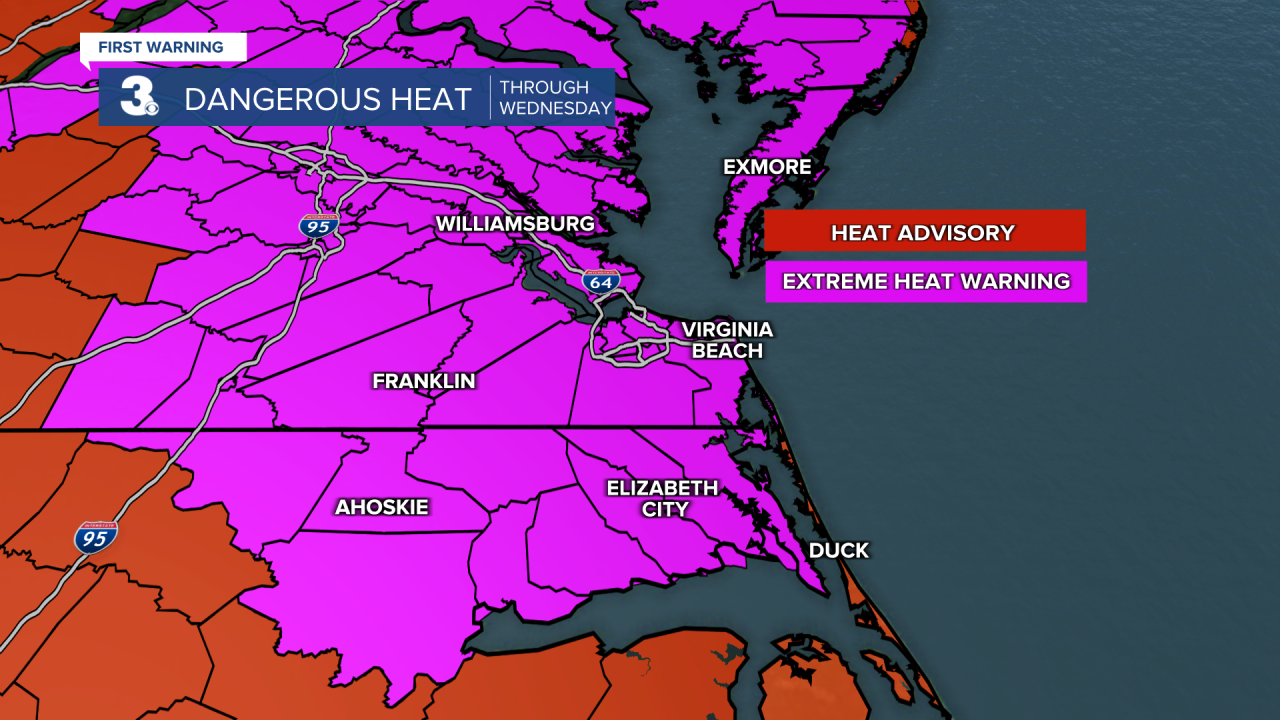
Extreme heat to start the week. Several days with a heat index to 100+ this week.
Highs will climb to the upper 90s today, 10 degrees above normal for this time of year. The heat index will reach 105 to 110 for many locations. Expect mostly sunny skies with light and variable winds.

Highs will return to the upper 90s tomorrow with an afternoon heat index near 110 for many locations. Expect mostly sunny skies with light and variable winds.

Highs will remain in the mid 90s for the second half of the week with afternoon heat index values near 105. Expect partly cloudy skies with a stray shower/storm possible.
Today: Mostly Sunny. Highs in the upper 90s. Winds: W/N/E 5-10
Tonight: Mainly Clear. Lows in the upper 70s. Winds: E/S 5-10
Tomorrow: Mostly Sunny. Highs in the upper 90s. Winds: W/N/E 5-10
Weather & Health
Pollen: Medium (Grasses)
UV Index: 11 (Extreme)
Air Quality: Moderate (Code Yellow)
Mosquitoes: Extreme
Tropical Update
Watching an area of low pressure located about 500 miles east of Bermuda. A short-lived tropical depression or storm could form today. By Tuesday, this system is expected to encounter less favorable environmental conditions, ending its opportunity for further development as it moves northeast over the open central Atlantic.
* Formation chance through 48 hours: High (70%)
* Formation chance through 7 days: High (70%)
Weather updates on social media:
Facebook: MylesHendersonWTKR
Instagram: @MylesHendersonWTKR
