




Meteorologist Myles Henderson’s First Warning Forecast
A step cooler with lower humidity and lower rain chances this week.
Another warm and muggy morning, but the humidity will be falling through the day. Highs will reach the low to mid 80s, near normal for this time of year. Expect partly cloudy skies with some clearing later in the day. It will be windy today, north at 10 to 20 with gusts to 30 mph.
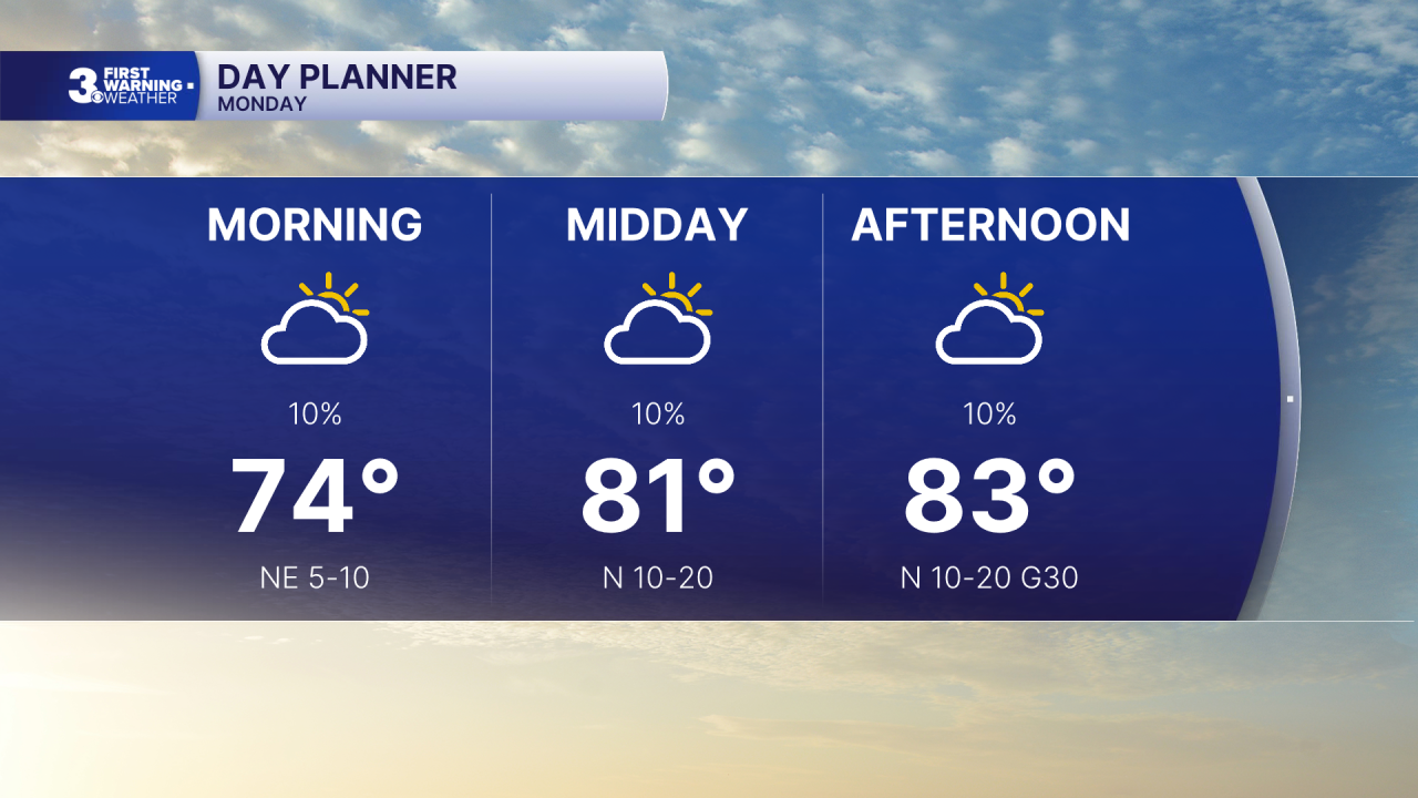
The weather looks great through midweek. Highs will linger in the low to mid 80s with low humidity (for September). Expect several days with mostly sunny skies.
Temperature and humidity will start to increase for the end of the week with highs in the upper 80s. Tracking the potential for a few showers/storms for the upcoming weekend as a cold front moves through.
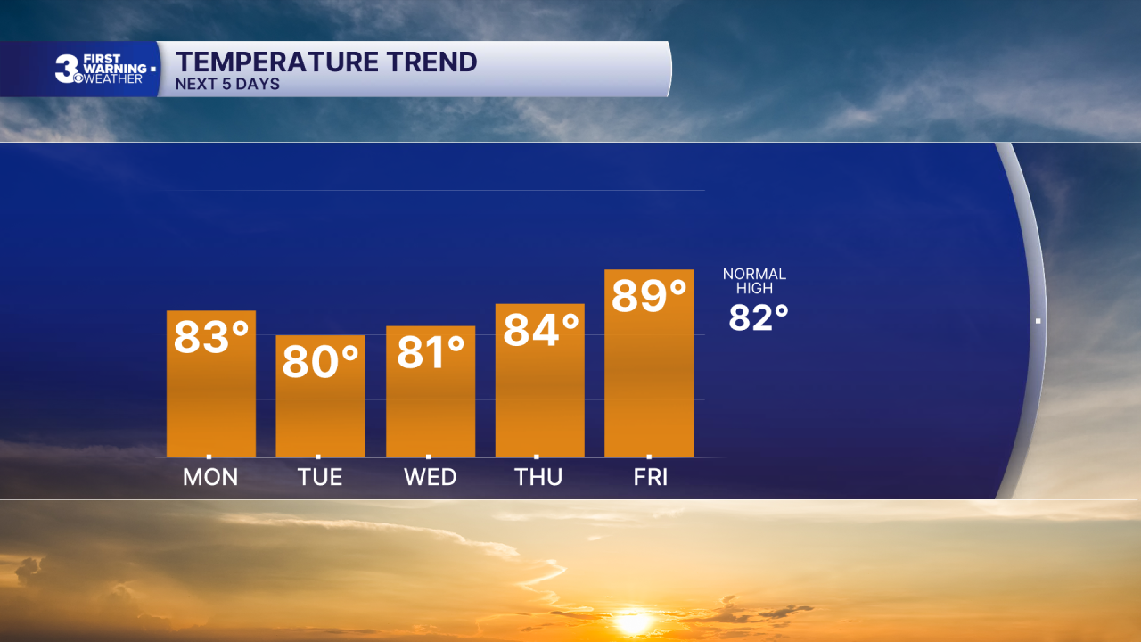
Today: Partly Cloudy, Windy. Highs in the mid 80s. Winds: N 10-20 G30
Tonight: Mainly Clear. Lows in the mid 60s. Winds: NE 10-15
Tomorrow: Mostly Sunny. Highs near 80. Winds: NE 5-15
Weather & Health
Pollen: Medium-High (Ragweed)
UV Index: 7 (High)
Air Quality: Good (Code Green)
Mosquitoes: Extreme
Tropical Update
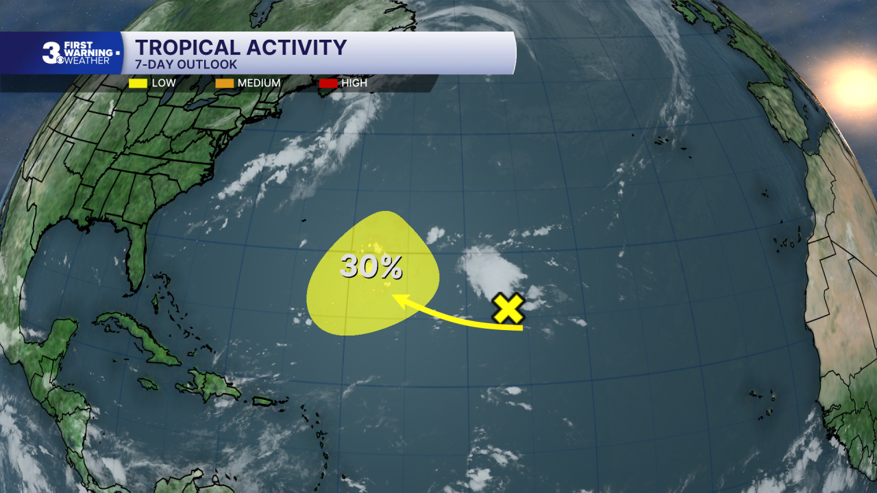
Watching a trough of low pressure located more than 1000 miles ESE of Bermuda. As the system moves WNW across the central part of the Subtropical Atlantic, it is forecast to enter a more conducive environment for gradual development by the middle to latter portion of this week.
* Formation chance through 48 hours: Low (0%)
* Formation chance through 7 days: Low (30%)
Weather updates on social media:
Facebook: MylesHendersonWTKR
Instagram: @MylesHendersonWTKR
