


Chief Meteorologist Patrick Rockey’s First Warning Forecast
Relief has finally arrived!
A powerful Canadian cold front will sweep through the region Friday evening ushering in lower temperatures and much lower humidity just in time for the weekend!

Once that front crosses the region, it will take the clouds and rain with it. That means we will wake up on Saturday morning to plenty of sunshine and high temperatures in the mid-to-upper 60s.

Our dewpoint values (which is a measure of humidity) will plunge into the 50s by Saturday afternoon. You will certainly notice the drop in humidity. Expect highs on Saturday only in the lower 80s.
We will add a few more clouds and a few more degrees to our temperatures on Sunday, but it is still going to be a very pleasant day.
After morning lows in the lower 60s we should climb into the mid 80s in the afternoon under partly cloudy skies.
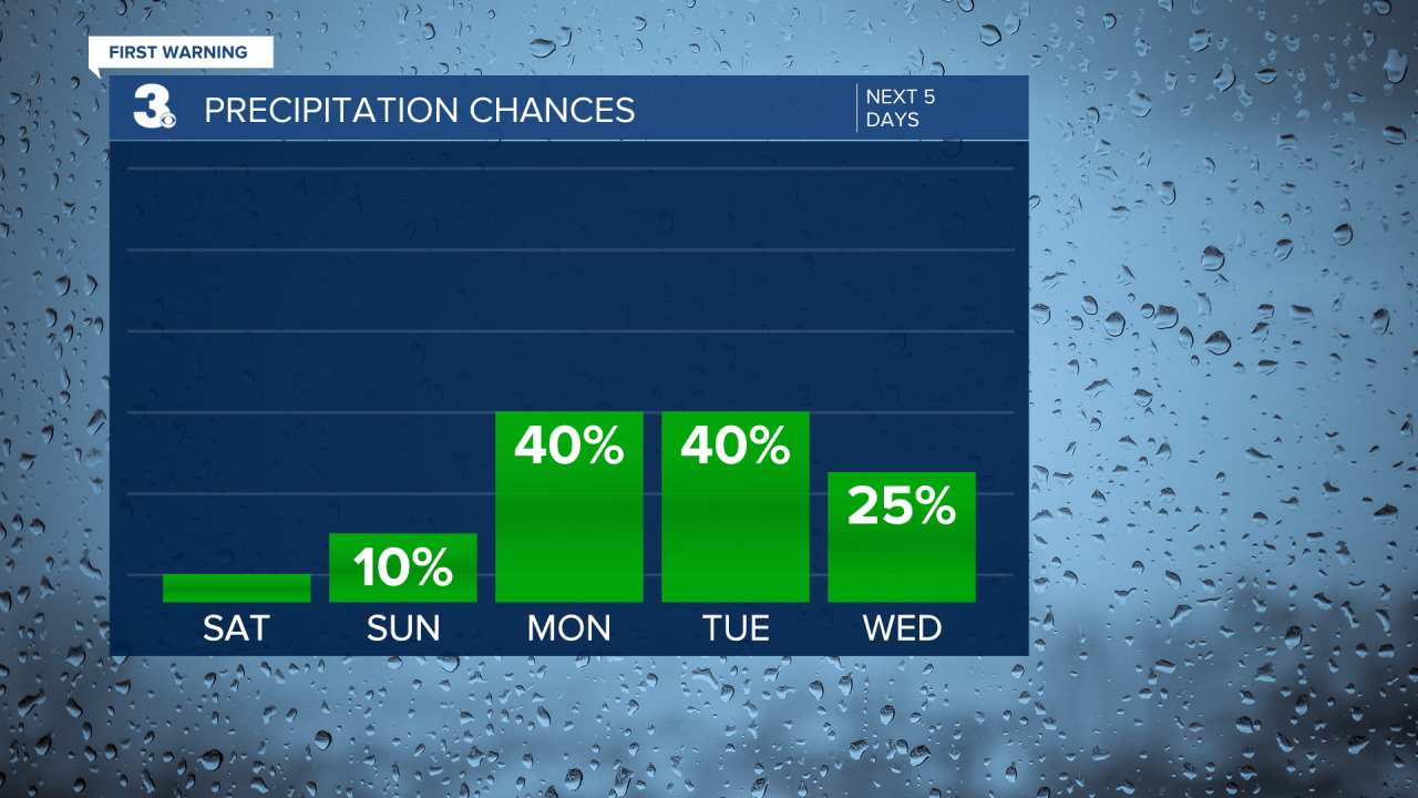
On Monday and Tuesday, another slow-moving cold front will cross the region. That will bring us a chance for showers and storms both days. And that will reinforce our cooler air.
We expect high temperatures in the lower 80s on Monday and only in the upper 70s in many areas on Tuesday!
More dry air will move in on Wednesday and with more sunshine around we expect temperatures to moderate back into the low-to-mid 80s to round out the work week and head into next weekend.
