


Meteorologist Myles Henderson’s First Warning Forecast
Falling temperatures today with a mix of clouds and spotty showers. Another warming trend from near 50 on Tuesday to the 70s by Thursday.
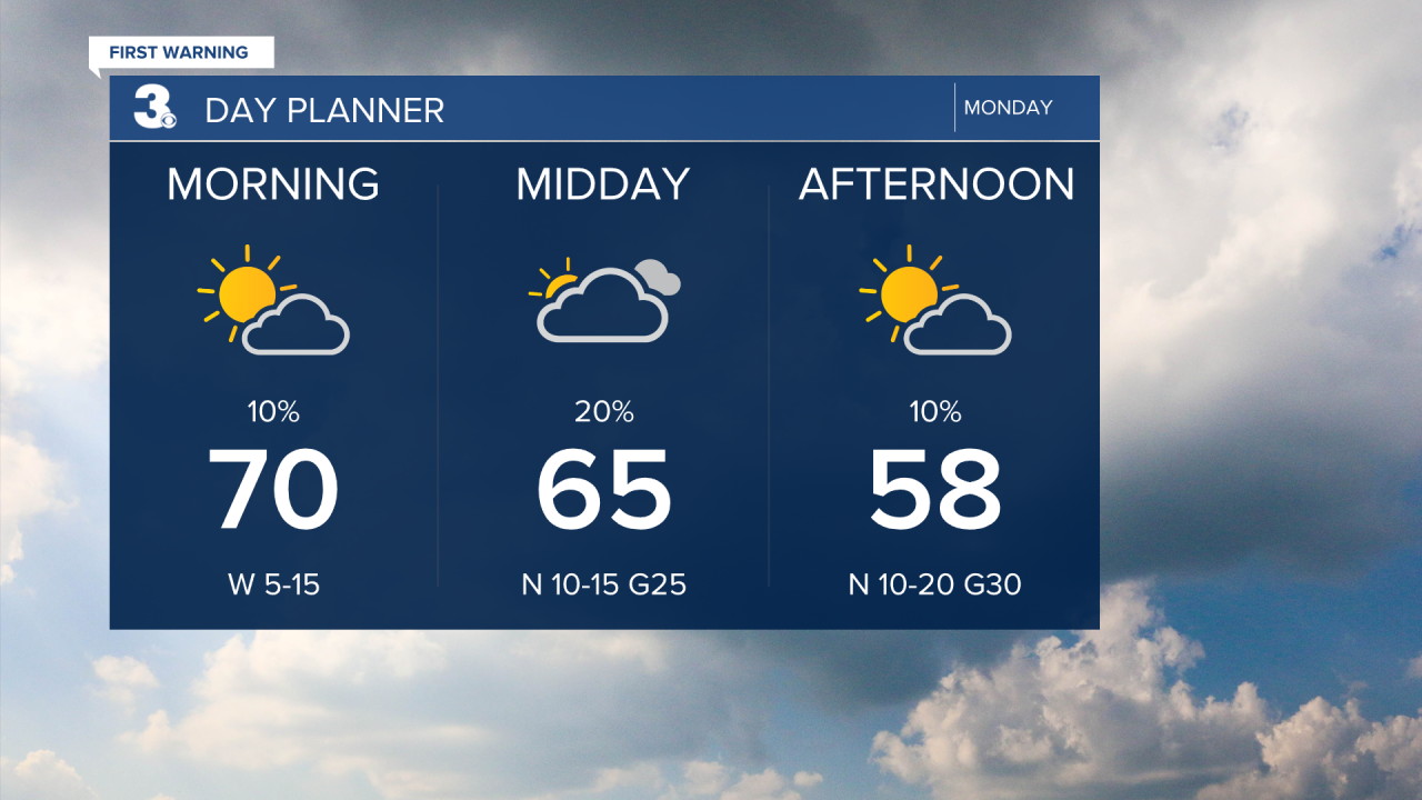
A mild start this morning with temperatures near 70, but temperatures will drop into the 50s this afternoon as a cold front moves through. Look for a mix of partly to mostly cloudy skies with a few showers possible. It will also become windy today with a north wind at 10 to 20 and gusts to 30 mph by the afternoon.
Sunny and cooler tomorrow with temperatures struggling to reach the 50s. It will still be breezy tomorrow with a NE wind at 10 to 15 mph.
We will warm up to end the week. Highs will climb to the low 60s on Wednesday and the mid 70s on Thursday and Friday.
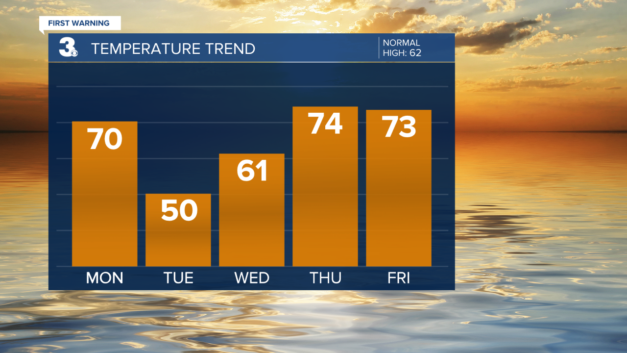
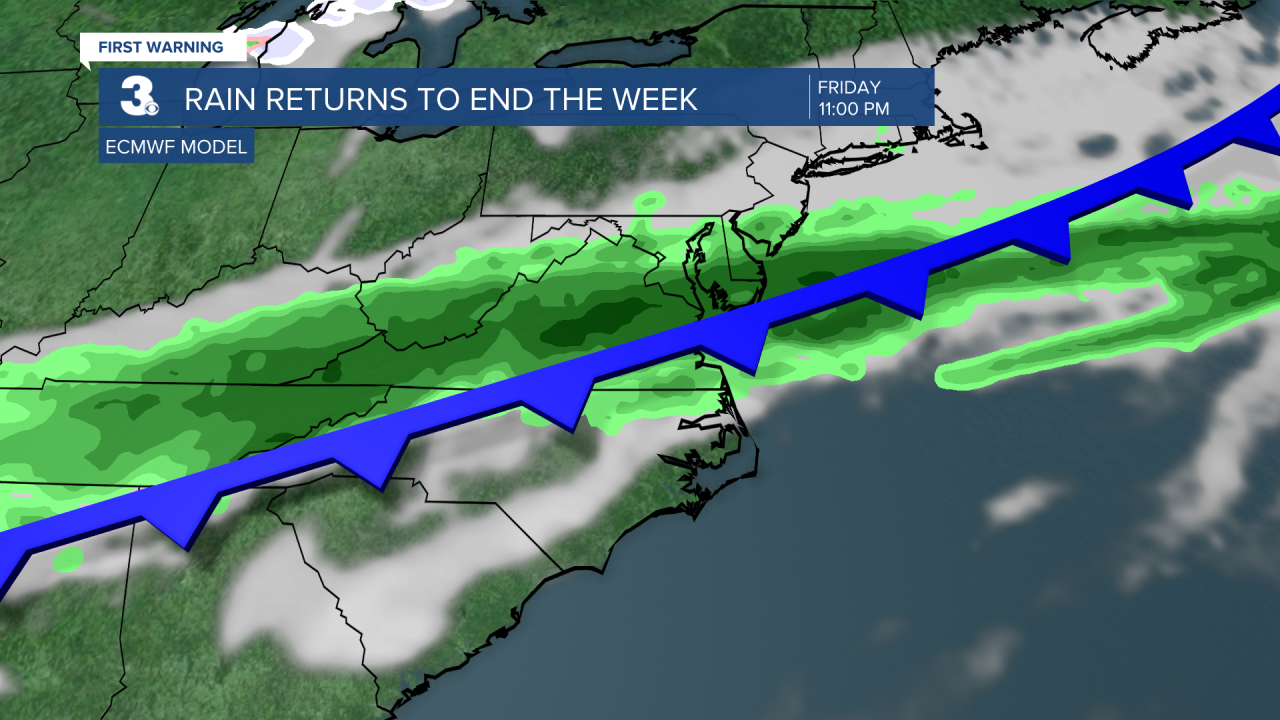
Another cold front is set to move in at the end of the week. Watch out for showers Friday night to Saturday morning and another cool down from the 70s to the 50s.
Today: Mix of Clouds, Windy. Falling from near 70 to the 50s. Winds: N 10-20G30
Tonight: Mainly Clear. Lows near 40. Winds: N 10-20G30
Tomorrow: Mostly Sunny. Highs near 50. Winds: NE 10-15
Weather & Health
Pollen: High (Juniper, Birch)
UV Index: 3 (Low-Moderate)
Air Quality: Good (Code Green)
Mosquitoes: Low
Weather updates on social media:
Facebook: MylesHendersonWTKR
Instagram: @MylesHendersonWTKR
