


Meteorologist Myles Henderson’s First Warning Forecast
A warm first half of the day, then a temperature drop. Tracking rain tonight with a cold front. Much cooler and mostly sunny this weekend.
We will warm to the mid and upper 70s by midday, then temperatures will drop to the 60s and 50s this afternoon. Watch for the winds to shift from SW to north as a cold front moves in. Temperatures will drop to the 40s tonight.

Rain chances will be small during the day but increase tonight. Expect a line of showers to move through from NW to SE from 6 PM to 2 AM.

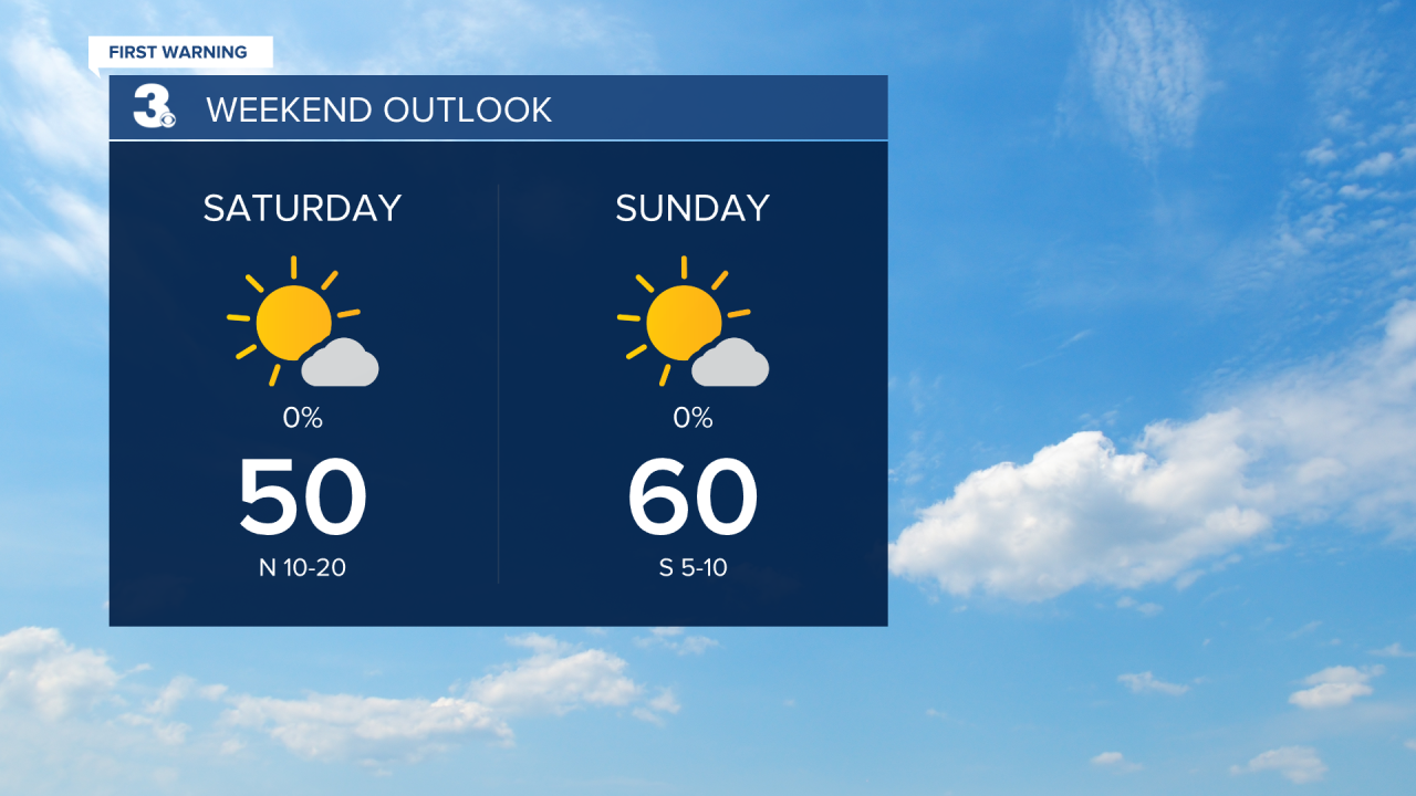
Overall, the weekend will be cooler but nice. Clouds should clear out early Saturday and we will see mostly sunny skies. Highs will only warm to near 50 and it will be windy with a north wind at 10 to 20 mph. We will warm to near 60 on Sunday with sunshine and light winds.
Highs will warm back to the 70s and 80s next week.
Today: Partly Cloudy, Windy. Highs in the upper 70s. Winds: SW/N 10-20
Tonight: Mostly Cloudy, Showers. Lows near 40. Winds: N 10-15
Tomorrow: Mostly Sunny, Windy. Highs near 50. Winds: N 10-20
Weather & Health
Pollen: Medium-High (Juniper, Elm, Poplar)
UV Index: 6 (Medium-High)
Air Quality: Moderate (Code Yellow)
Mosquitoes: Low
Weather updates on social media:
Facebook: MylesHendersonWTKR
Instagram: @MylesHendersonWTKR
