

Derrah Getter's First Warning Forecast
This evening will be warm but comfortable. Skies cleared up nicely today. We maintain the mostly clear skies tonight with lows in the upper 60s.

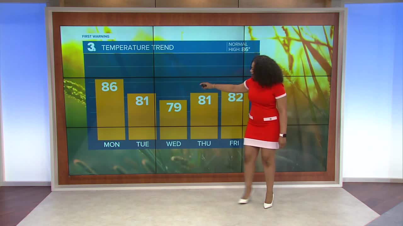
Monday will start out fairly bright but more clouds build in during the afternoon. There will be a chance of spotty storms with highs in the mid 80s. The humidity will cause it to feel more like 90 degrees.

A cold front crosses the region Monday afternoon. Behind the front, a strong ridge of high pressure will build causing below normal temps and low rain chances. We'll see plenty of sunshine all week long.
Isolated storm chances return by the upcoming weekend.

2025 Atlantic Hurricane Season Update
Tropical Storm Fernand is expected to maintain tropical storm strength as is moves north over the central Atlantic. Weakening is expected by the middle of the week. It is not expected to bring any impacts to land.

A system is producing disorganized showers and thunderstorms near the Winward Islands. The system is expected to move into conditions that will be less favorable for development early this week.
Formation chance through 48 hours...LOW...30%
Formation chance through 48 hours...LOW...30%

Let's connect on social media!
Forecaster Derrah Getter:
For weather updates on Facebook: HERE
For weather updates on X: HERE
Follow me on Instagram: HERE
Check out the Interactive Radar on WTKR.com: Interactive Radar
