


Meteorologist Myles Henderson’s First Warning Forecast
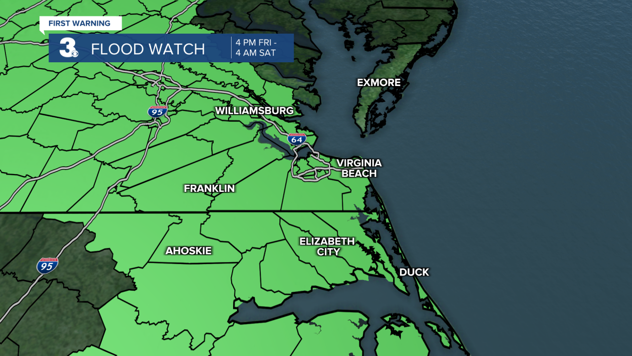
*** Flood Watch for most of SE VA and NE NC from 4 pm Friday to 4 am Saturday. Showers and thunderstorms are likely this afternoon and evening. Localized rainfall totals of 2 to 4 inches are possible.
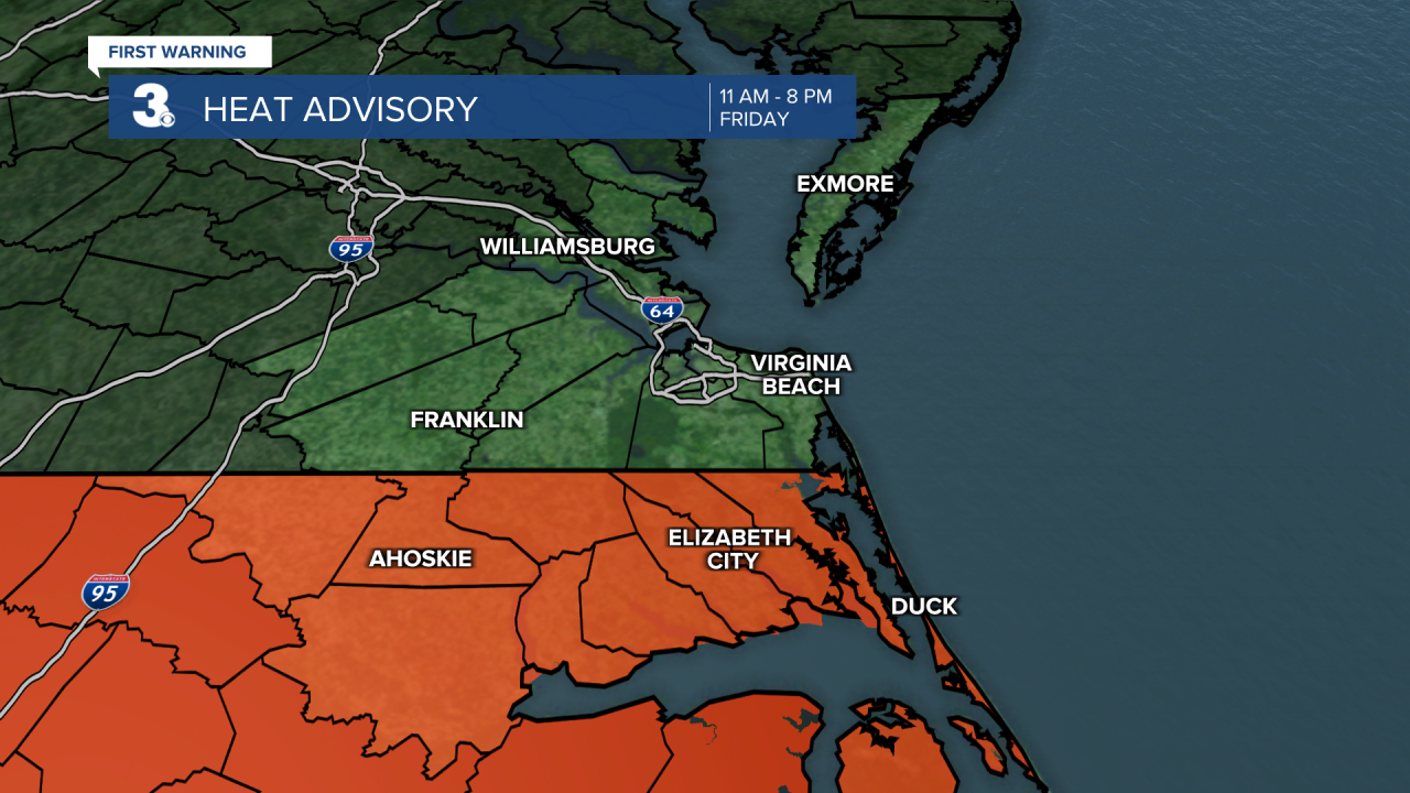
*** Heat Advisory for most of NE NC from 11 am to 8 pm Thursday. Heat index values will reach 105 to 109. ***
Still hot and humid with more thunderstorms. Storm chances linger through the weekend.
Hot and humid again today with highs in the low 90s and an afternoon heat index in the triple digits. Expect partly cloudy skies with showers and storms building this afternoon to evening. The biggest storm chances will be between 5 pm and 9 pm. Strong to severe storms are possible with a risk for localized flooding.

This trend continues for the weekend. Expect highs in the low 90s with a heat index in the triple digits. Scattered showers and storms are likely, mainly in the afternoons.
It looks like we will break out of this summer-like weather pattern next week. Highs will drop to the 80s with a dip in the humidity and lower rain chances.

Today: Afternoon Storms. Highs in the low 90s. Winds: W/N/E 5-10
Tonight: Scattered Storms. Lows in the mid 70s. Winds: E/S 5-10
Tomorrow: Afternoon Storms. Highs in the low 90s. Winds: S 5-10
Weather & Health
Pollen: Medium (Grasses)
UV Index: 10 (Very High)
Air Quality: Good (Code Green)
Mosquitoes: Extreme
Tropical Update
No tropical activity at this time
Weather updates on social media:
Facebook: MylesHendersonWTKR
Instagram: @MylesHendersonWTKR
