




Meteorologist Myles Henderson’s First Warning Forecast
Rain chances linger to end the week. A break from the heat and humidity.
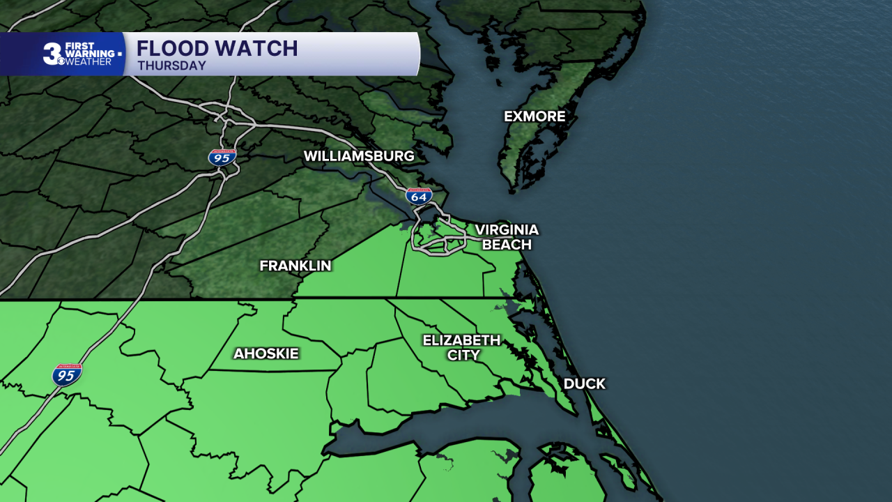
*** Flood Watch is in effect Thursday for parts of the Southside and NE NC. An additional 1 to 3 inches of rain are possible with locally higher amounts.
A slow-moving cold front will continue sliding through the region today. Expect mostly cloudy skies with on and off showers and storms. Expect higher rain chances to the south and lower chances north. Some storms could be strong with localized flooding and gusty winds. Highs will only reach the low 80s today, with lower humidity.

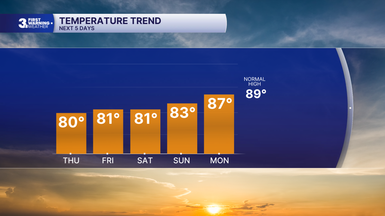
Leftover showers are possible Friday, mainly in NE NC. Highs will return to near 80, almost 10 degrees below normal for this time of year.
Highs will remain in the low to mid 80s this weekend with a break in the humidity. Expect partly cloudy skies with scattered showers possible Saturday and lower rain chances Sunday.
Today: Showers & Storms. Highs near 80. Winds: NE 5-10
Tonight: Showers & Storms. Lows in the low 70s. Winds: NE 5-10
Tomorrow: Scattered Showers. Highs near 80. Winds: NE 5-15
Weather & Health
Pollen: Low (Grasses)
UV Index: 2 (Low)
Air Quality: Good (Code Green)
Mosquitoes: Extreme
Tropical Update
Tropical Storm Bertha is moving generally west along the Gulf Coast. On the forecast track, the center of Bertha will move near or along the Louisiana and upper Texas coasts during the next several hours and then move inland over Texas this evening.
Maximum sustained winds remain near 45 mph with higher gusts. Little change in strength is expected today, and Bertha is forecast to maintain tropical storm intensity until it reaches the upper Texas coast later today. The system is expected to dissipate inland over Texas late tonight or Friday.

Weather updates on social media:
Facebook: MylesHendersonWTKR
Instagram: @MylesHendersonWTKR
