

Derrah Getter's First Warning Forecast
Cool, clear and sunny conditions continue through the start of the weekend.

This evening will be gorgeous with mostly clear skies. Lows fall into the 30s and 40s. A frost advisory is in place from 2 am through 9 am Saturday morning for the following areas: Gloucester, James City, Williamsburg, Surry, Sussex, Isle of White, Southampton, Suffolk, Northampton, Hertford, Gates and Bertie.
High temperatures will struggle to reach 60 degrees Saturday. It will be chilly but beautiful with mostly sunny skies. Temperatures remain cool Sunday with highs in the low to mid 60s underneath a mix of clouds and sunshine.
Rain returns with a developing coastal storm next week. Scattered showers will be possible Monday through Thursday. Conditions will dry out just in time for Halloween trick-or-treating Friday.

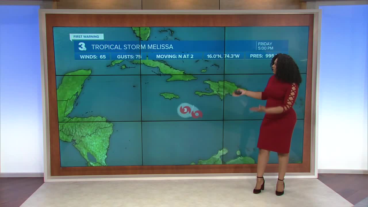
2025 Atlantic Hurricane Season Update:
Tropical Storm Melissa has begun reorganizing and is on track to intensify. The storm is to become a category 1 hurricane by the end of the weekend. It’s forecast to reach major hurricane status and become a category 4 storm by early next week.Latest model guidance brings the storm near the U.S. east coast, but it is expected to remain offshore.

Let's connect on social media!
Forecaster Derrah Getter:
For weather updates on Facebook: HERE
For weather updates on X: HERE
Follow me on Instagram: HERE
Check out the Interactive Radar on WTKR.com: Interactive Radar
