


Meteorologist Myles Henderson’s First Warning Forecast
Rain showers and mixed precipitation with a big cool down today. Back to sunshine and near normal for Friday.
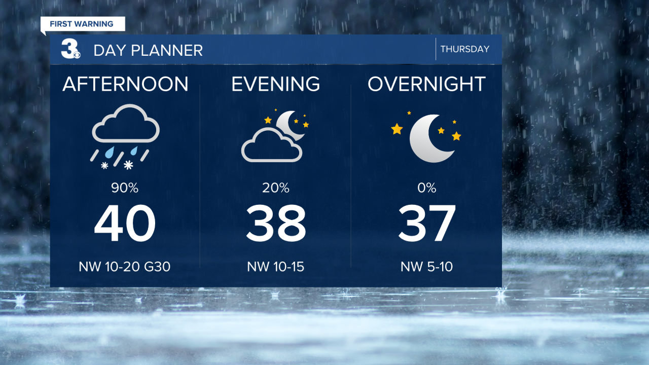
A cold front is set to move through today, bringing in rain and a major cool down. Showers will start later in the morning and move out in the late afternoon to early evening. Some sleet or snow could mix in as the moisture exits but little to no accumulation is expected. Temperatures will start near 70 this morning then fall to the 30s by the early afternoon. It will also be windy with wind gusts to near 30 mph.
Back to normal on Friday with highs in the upper 50s to near 60. Expect mostly sunny skies with lighter winds.
Saturday looks like the pick of the weekend with partly cloudy skies and highs in the low 60s. Winds will kick up on Sunday with highs in the upper 60s and rain moving in later in the day.

Today: Showers, Windy. Temperatures falling into the 30s. Winds: NW 10-20G30
Tonight: Clearing Skies. Lows in the mid 30s. Winds: NW 5-10
Tomorrow: Mostly Sunny. Highs in the upper 50s. Winds: S 5-15
Weather & Health
Pollen: Low-Medium (Juniper, Maple, Ash)
UV Index: 1 (Low)
Air Quality: Good (Code Green)
Mosquitoes: Low
Weather updates on social media:
Facebook: MylesHendersonWTKR
Instagram: @MylesHendersonWTKR
