

Derrah Getter's First Warning Forecast
This evening will be sunny for most and stormy for some.

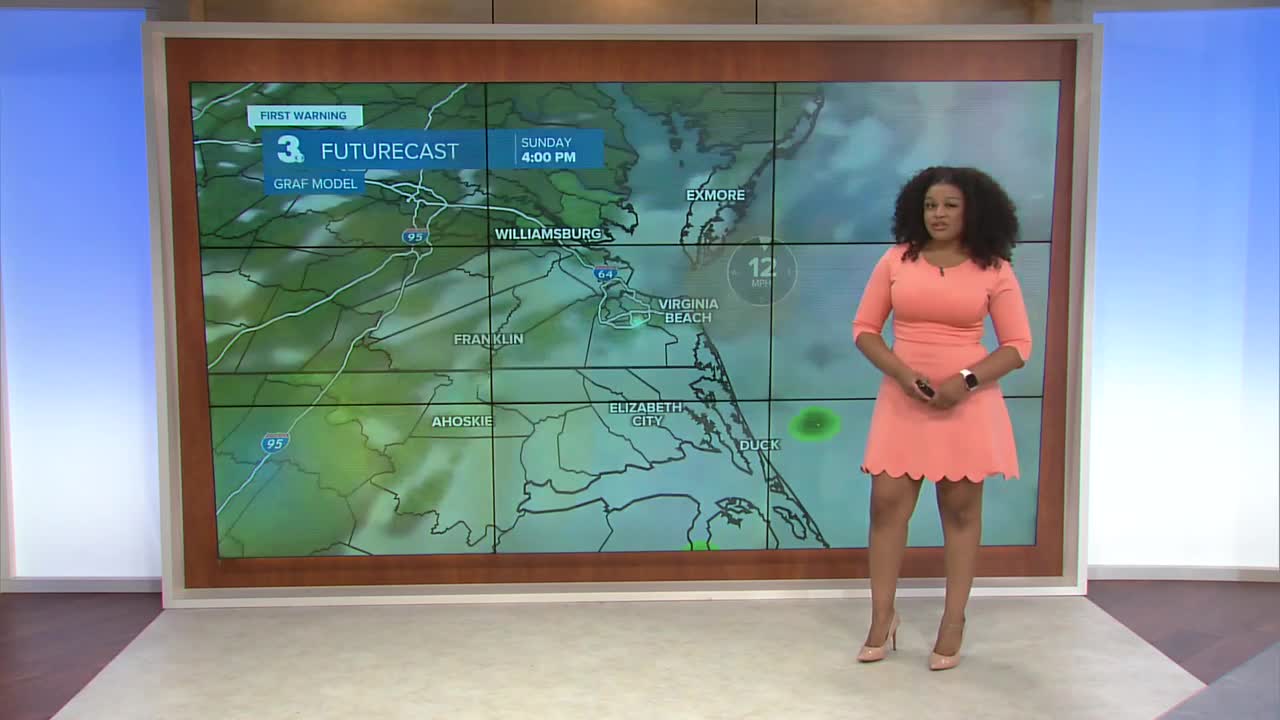
Isolated thunderstorms move through portions of the Peninsulas where a cold front is approaching. Mostly cloudy skies and scattered showers and storms return to the rest of the area on Sunday. As the cold front passes, temperatures fall from the low 90s Saturday to the low 70s Sunday.

As skies clear on Monday, high temperatures hover in the mid 70s for the rest of the week. A few isolated showers and storms will be possible during the middle of the week.
Next weekend is looking mostly dry with plenty of sunshine.

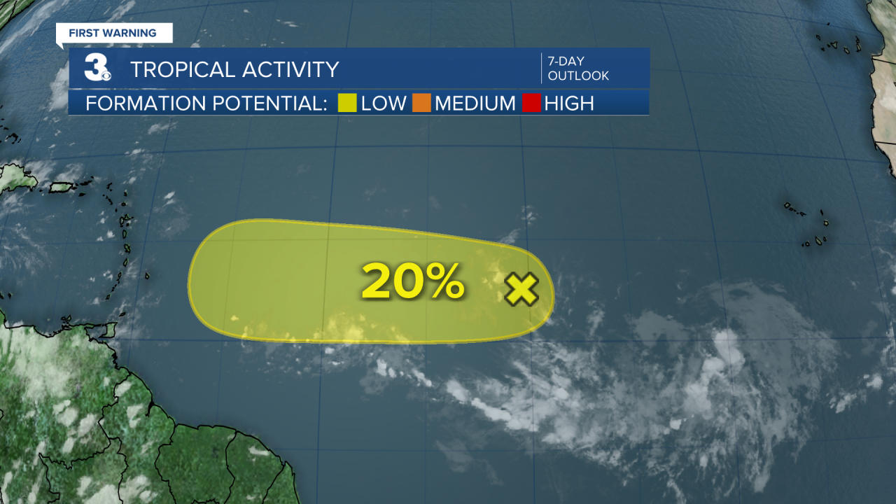
2025 Atlantic Hurricane Season Update:
A tropical wave over the central Atlantic is producing a small area of shower activity. Environmental conditions are only slightly beneficial for the development of this system. The chances of this area becoming a tropical depression continues to diminish.
Formation chance through 48 hours...LOW...20%
Formation chance through 7 days...LOW...20%
Let's connect on social media!
Forecaster Derrah Getter:
For weather updates on Facebook: HERE
For weather updates on X: HERE
Follow me on Instagram: HERE
Check out the Interactive Radar on WTKR.com: Interactive Radar
