


Meteorologist Myles Henderson’s First Warning Forecast
Windy through midweek with clearing skies. A stretch of below normal days with falling humidity.
Gloomy again today with mostly cloudy skies and spotty showers/drizzle. A stationary front continues to linger along the coast and Imelda skirts just off the southern East Coast. Highs will reach the mid 70s and the wind will continue to pick up.

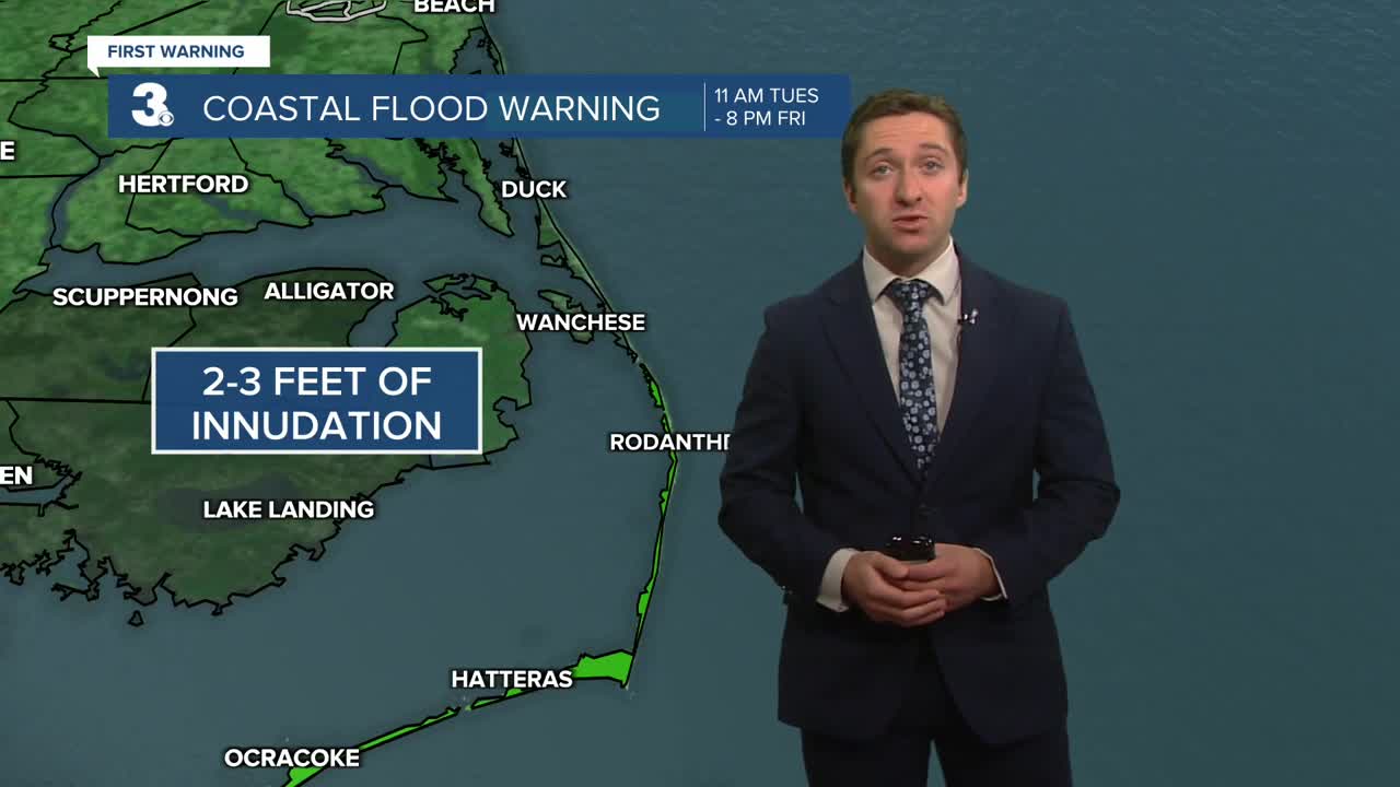
Look for clearing skies on Wednesday, mostly to partly cloudy. Highs will dip to low 70s and the humidity will start to fall. It will still be windy with gusts to 30+ mph. The persistent NE winds could trigger some minor flooding near times of high tide.
Expect a nice mix of sun and clouds with highs in the low 70s and lower humidity to end the work week. Winds will relax through the end of the week.

Today: Mostly Cloudy, Windy. Highs in the mid 70s. Winds: NE 10-20 G25
Tonight: Mostly Cloudy, Windy. Lows in the upper 60s. Winds: NE 10-20 G30
Tomorrow: Clearing Skies, Windy. Highs in the low 70s. Winds: NE 10-20 G30
Weather & Health
Pollen: Low (Ragweed)
UV Index: 5 (Medium)
Air Quality: Good (Code Green)
Mosquitoes: Very High
Tropical Update
Hurricane Humberto brings dangerous surf and rip currents to the East Coast. On the forecast track, the center of Humberto will pass west of, and then north of Bermuda today and Wednesday.
Maximum sustained winds have decreased to near 100 mph with higher gusts. Continued weakening is forecast, with Humberto expected to become a strong extratropical system on Wednesday.

Imelda strengthens to a hurricane. On the forecast track, the center of the system should move away from the Bahamas today and quickly be approaching Bermuda late on Wednesday.
Maximum sustained winds are near 75 mph with higher gusts. Some additional strengthening is forecast during the next 48 hours.

Weather updates on social media:
Facebook: MylesHendersonWTKR
Instagram: @MylesHendersonWTKR
