

Derrah Getter's First Warning Forecast
Showers and storms return this week.

This evening, mostly cloudy skies prevail. Lows will generally be in the upper 40s and low 50s.
Isolated showers will be possible throughout the day on Monday. Skies will be mostly cloudy with highs in the low 60s. An approaching coastal storm causes rain chances to ramp up Monday night through Tuesday. Winds will pick up as well with gusts up to 40 mph. Tidal flooding will continue through the end of the week.

A second round of rain arrives Wednesday through Thursday with a potentially strong low pressure system. Gusty wind and rain continue through early Friday morning.
Good news, we dry out just in time for Halloween on Friday. Temperatures will be in the 50s for trick-or-treating.
The upcoming weekend looks nice and mainly dry with temperatures in the low 60s.

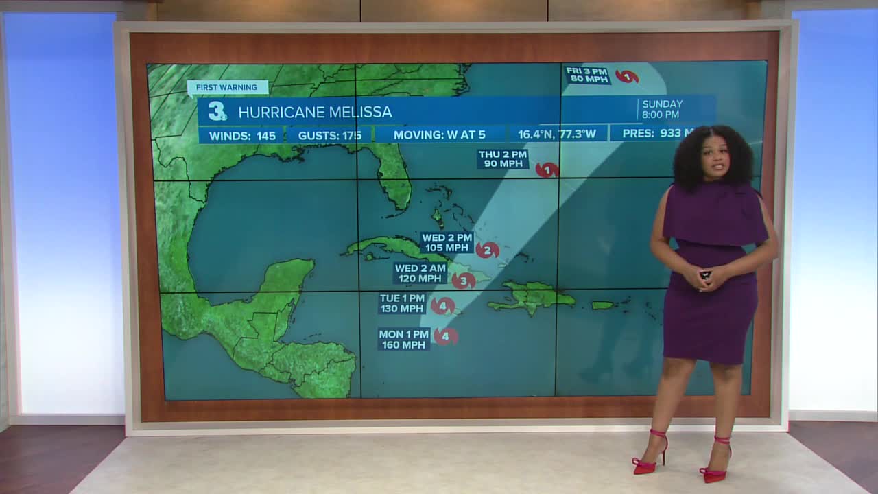
2025 Atlantic Hurricane Season Update:
Melissa has rapidly intensified into a category 4 hurricane. Winds are currently at 145 mph. Life-threatening conditions are expected across Jamaica, Haiti and Eastern Cuba making it our most impactful hurricane so far this season. Impacts to Hampton Roads and Northeast North Carolina are not expected. Back-to-back low pressure systems will keep Melissa away from the U.S. east coast.

Let's connect on social media!
Forecaster Derrah Getter:
For weather updates on Facebook: HERE
For weather updates on X: HERE
Follow me on Instagram: HERE
Check out the Interactive Radar on WTKR.com: Interactive Radar
