

Derrah Getter's First Warning Forecast
We're trading the clouds and cooler temperatures for more sunshine and warmer weather.

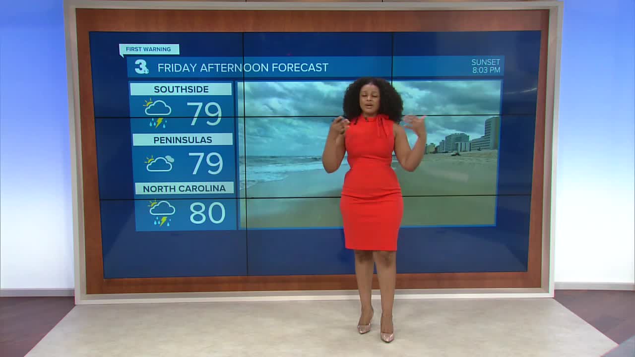
This afternoon highs struggle to reach the 80s underneath a pretty thick layer of cloud cover. Breezy northeasterly winds pull in some wildfire smoke so there is a moderate air quality concern today. The northeasterly winds will also lead to rough surf and minor tidal flooding. A few spotty hit-or-miss showers will be possible through the evening.

The clouds stick around through the first part of the weekend. Rain chances decrease with Sunday being the drier of the two weekend days. Highs climb into the low 90s by the start of next week.

2025 Atlantic Hurricane Season Update:
As of 11 am August 7
We're keeping an eye on two areas of potential development.
The first is just off the coast of the Carolinas. It is forecast to continue drifting northeastward where it will move into cooler waters and additional development will cease.
Formation chance through 48 hours...low...10%
Formation chance through 7 days...low...20%
There is another disturbance over the eastern Atlantic. Gradual development is expected with a tropical depression potentially forming over the weekend.
Formation chance through 48 hours...low...10%
Formation chance through 7 days...medium...60%

Let's connect on social media!
Forecaster Derrah Getter:
For weather updates on Facebook: HERE
For weather updates on X: HERE
Follow me on Instagram: HERE
Check out the Interactive Radar on WTKR.com: Interactive Radar
