



Meteorologist Myles Henderson’s First Warning Forecast
More heat and humidity to end the week. Tracking a cold front that will increase rain chances but drop the temperatures.
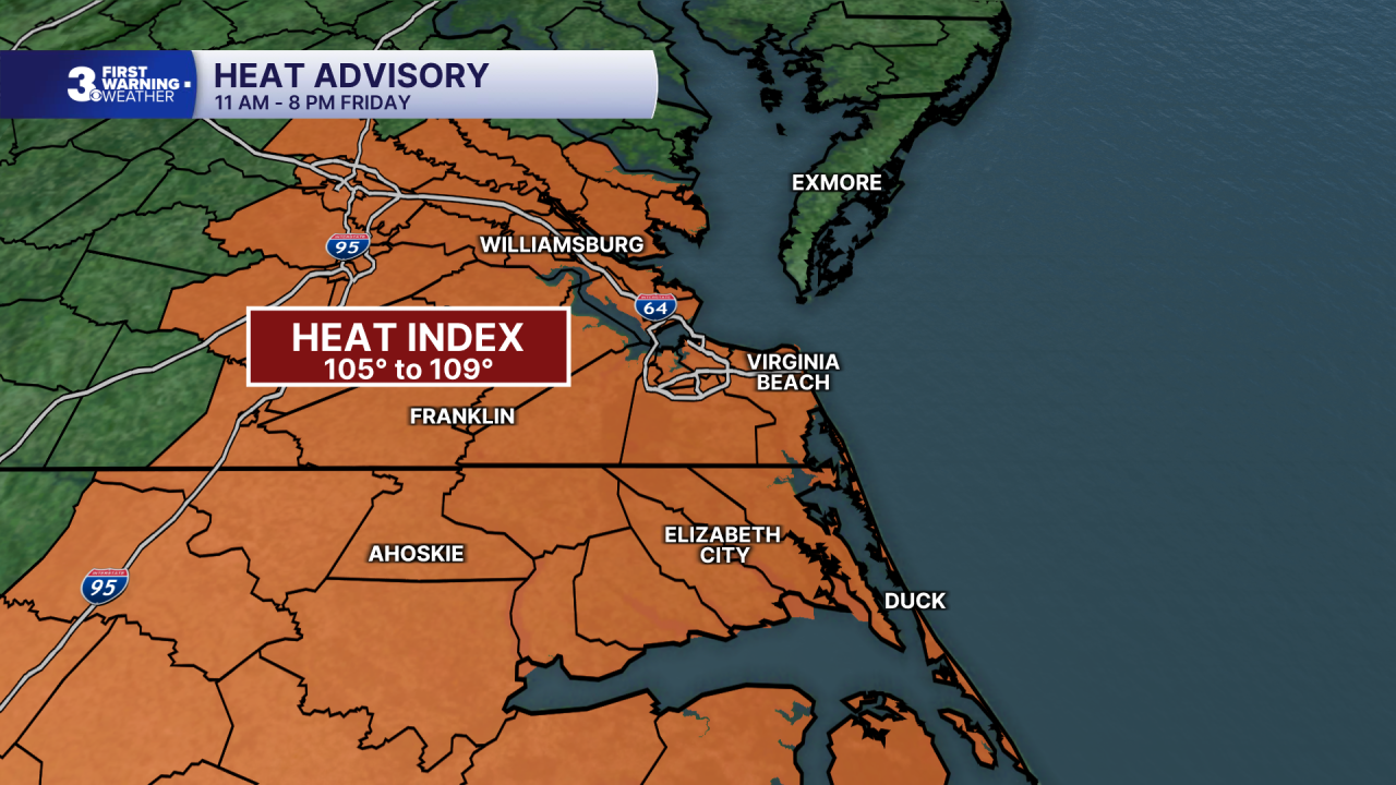
***A Heat Advisory is in effect from 11 AM to 8 PM Friday for most of SE Virginia and NE North Carolina. Heat index values will reach 105 to 109 today.
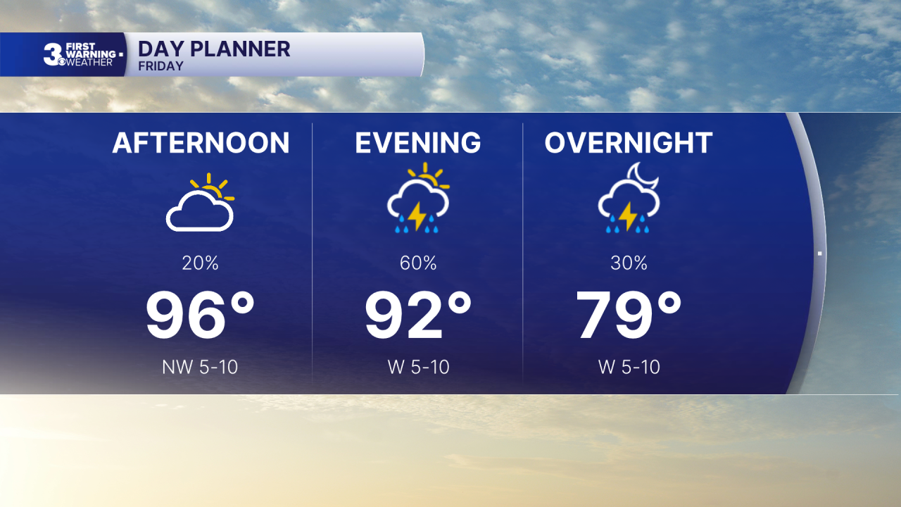
Hot and humid again today with highs in the mid 90s and an afternoon heat index to 105+. Expect a mix of mostly sunny to partly cloudy skies with a “pop-up” shower/storm possible during the day. Rain chances will increase this evening and tonight as a cold front moves in. Strong to severe storms are possible.
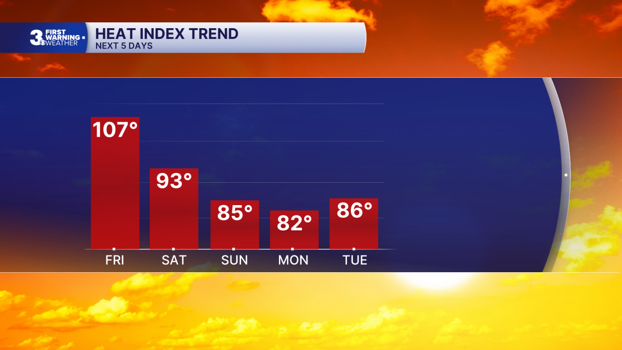
Scattered showers and storms will linger for Saturday as the cold front drifts to the south. Highs will drop to the mid 80s tomorrow, but it will still be humid. Expect partly cloudy skies Sunday with a slim rain chance, highs in the low 80s, and lower humidity.
Labor Day looks great with mostly sunny skies, highs near 80, and low humidity (for September). Temperatures will start to warm again through midweek.
Today: Sun & Clouds. Highs in the mid 90s. Winds: W 5-10
Tonight: Scattered Storms. Lows in the upper 70s. Winds: W 5-10
Tomorrow: Scattered Storms. Highs in the mid 80s. Winds: N 5-10
Weather & Health
Pollen: High (Ragweed, Grasses)
UV Index: 8 (High)
Air Quality: Moderate (Code Yellow)
Mosquitoes: Extreme
Tropical Update
No tropical activity at this time
Weather updates on social media:
Facebook: MylesHendersonWTKR
Instagram: @MylesHendersonWTKR
