


Call it the last of the worst. We have one more dangerously hot day headed our way before it just becomes good old regular hot.
Tuesday will bring another afternoon with highs near the century mark with feels-like temperatures near 110°.
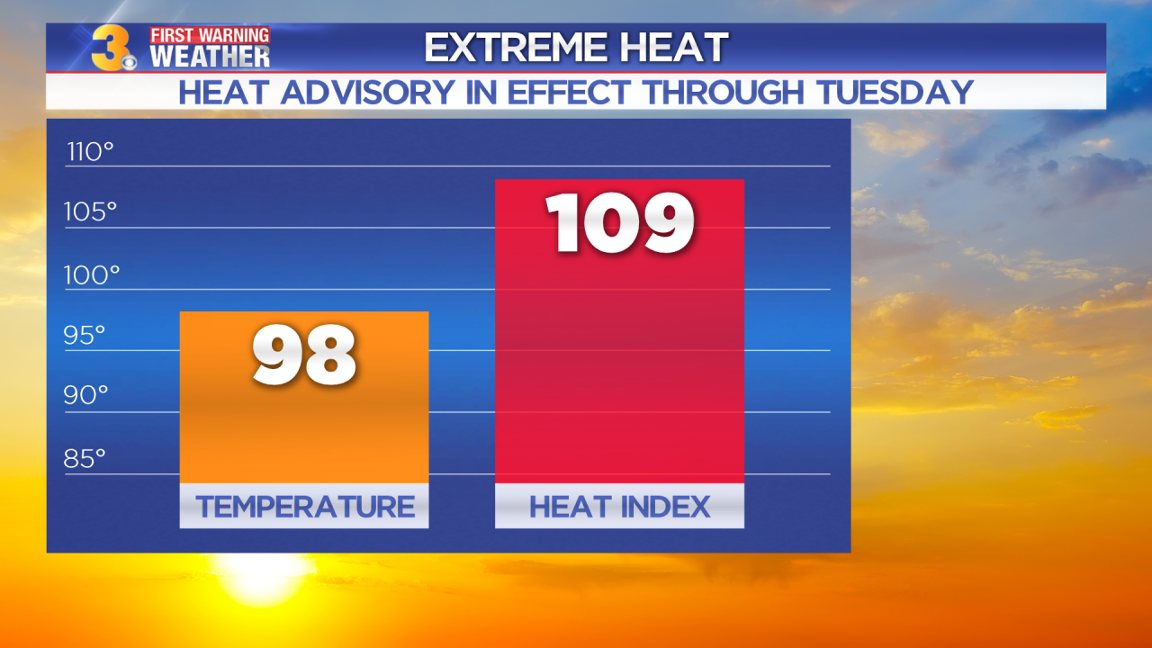
In fact, there's a Heat Advisory in effect for all of Hampton Roads and Eastern North Carolina until 8 PM Thursday. A Heat Advisory means the heat and humidity combined could prove dangerous for some people.

But there is relief on the way in the form of a cold front. It won't exactly bring cold air. In fact, most of the relief will come because of the extra clouds and showers and storms we're expecting ahead of the front.
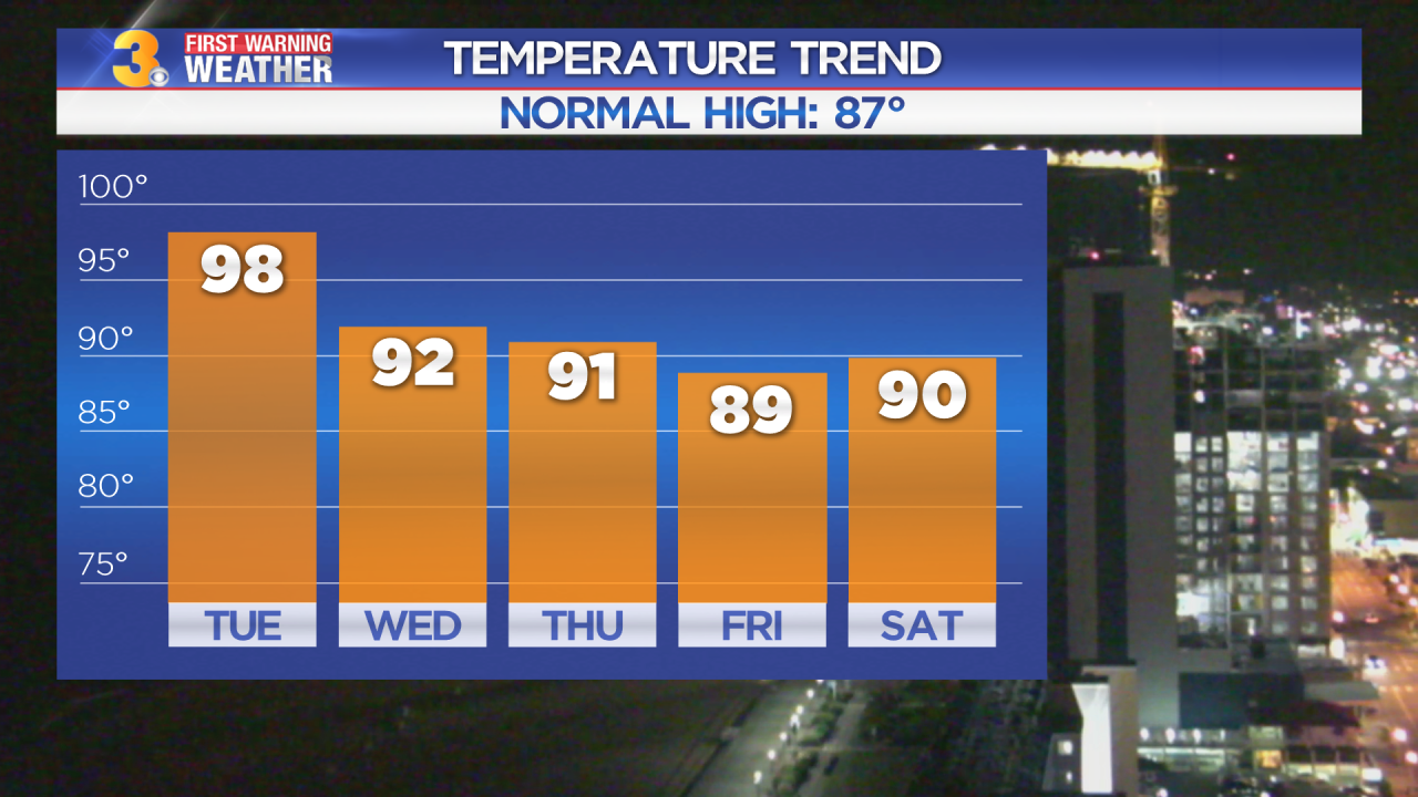
But we'll take the relief any way it comes. Our high temperatures will drop into the upper 80s and lower 90s beginning on Wednesday and stick around through the weekend and at least early next week
