




Meteorologist Myles Henderson’s First Warning Forecast
The heat and humidity continue to start the work week. Several chances for scattered showers and storms this week.
Hot & humid again today with highs in the low to mid 90s and an afternoon heat index to 100+. We will see partly cloudy skies with scattered showers/storms possible, mainly this afternoon to evening.

Hot & humid again tomorrow with highs in the low to mid 90s and an afternoon heat index to 100+. We will see a bigger chance for showers and thunderstorms with a risk for severe storms.
The pattern of heat, humidity, and scattered storms continues through midweek. Changes move in for the end of the week behind a cold front. Highs will drop to the 80s by Friday and the weekend.

Today: Partly Cloudy. Highs in the mid 90s. Winds: SW 5-15
Tonight: Partly Cloudy. Lows in the mid 70s. Winds: SW 5-10
Tomorrow: Scattered Storms. Highs in the mid 90s. Winds: W 5-10
Weather & Health
Pollen: Medium-High (Grasses)
UV Index: 9 (Very High)
Air Quality: Moderate (Code Yellow)
Mosquitoes: Extreme
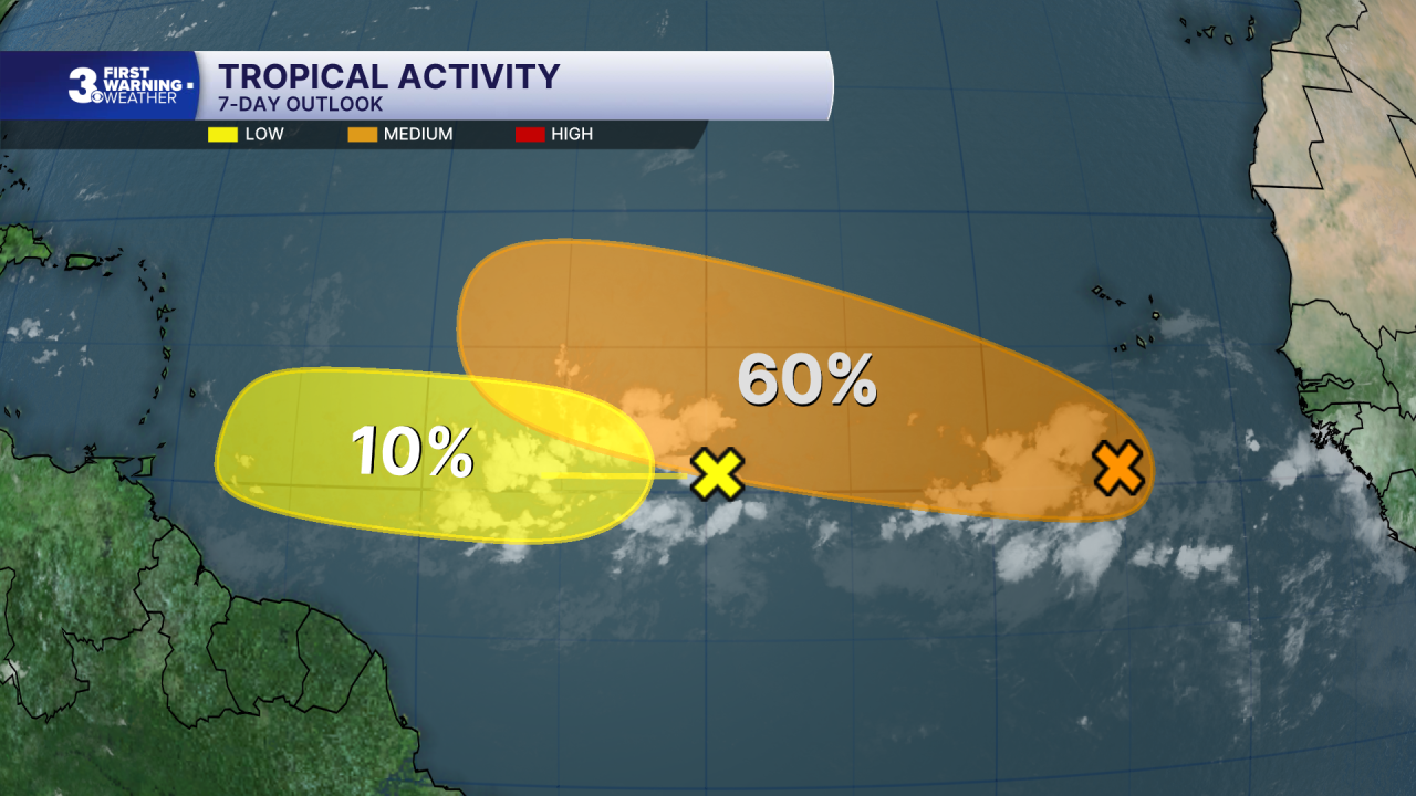
Tropical Update
Tracking a small area of low pressure south of the Cabo Verde Island. Environmental conditions are forecast to be more conducive for development by midweek, and a tropical depression could form during the latter half of this week while the system moves west to WNW across the central tropical Atlantic.
* Formation chance through 48 hours: Low (20%)
* Formation chance through 7 days: Medium (60%)
Watching a tropical wave located about midway between the coast of Africa and the Lesser Antilles. Some gradual development is possible through mid-week while it moves quickly westward across the central tropical Atlantic.
* Formation chance through 48 hours: Low (10%)
* Formation chance through 7 days: Low (10%)
Watching a trough of low pressure located a few hundred miles northwest of Bermuda. Some development of this system is possible during the next couple of days while it moves quickly eastward, well to the north of Bermuda.
* Formation chance through 48 hours: Low (10%)
* Formation chance through 7 days: Low (10%)
Weather updates on social media:
Facebook: MylesHendersonWTKR
Instagram: @MylesHendersonWTKR
