


Meteorologist Myles Henderson’s First Warning Forecast
Feeling like the triple digits to end the work week. Several chances for scattered showers/storms ahead.
***Heat Advisory from 11 AM to 8 PM Friday for most of SE VA and NE NC. Heat index to 105+ this afternoon.

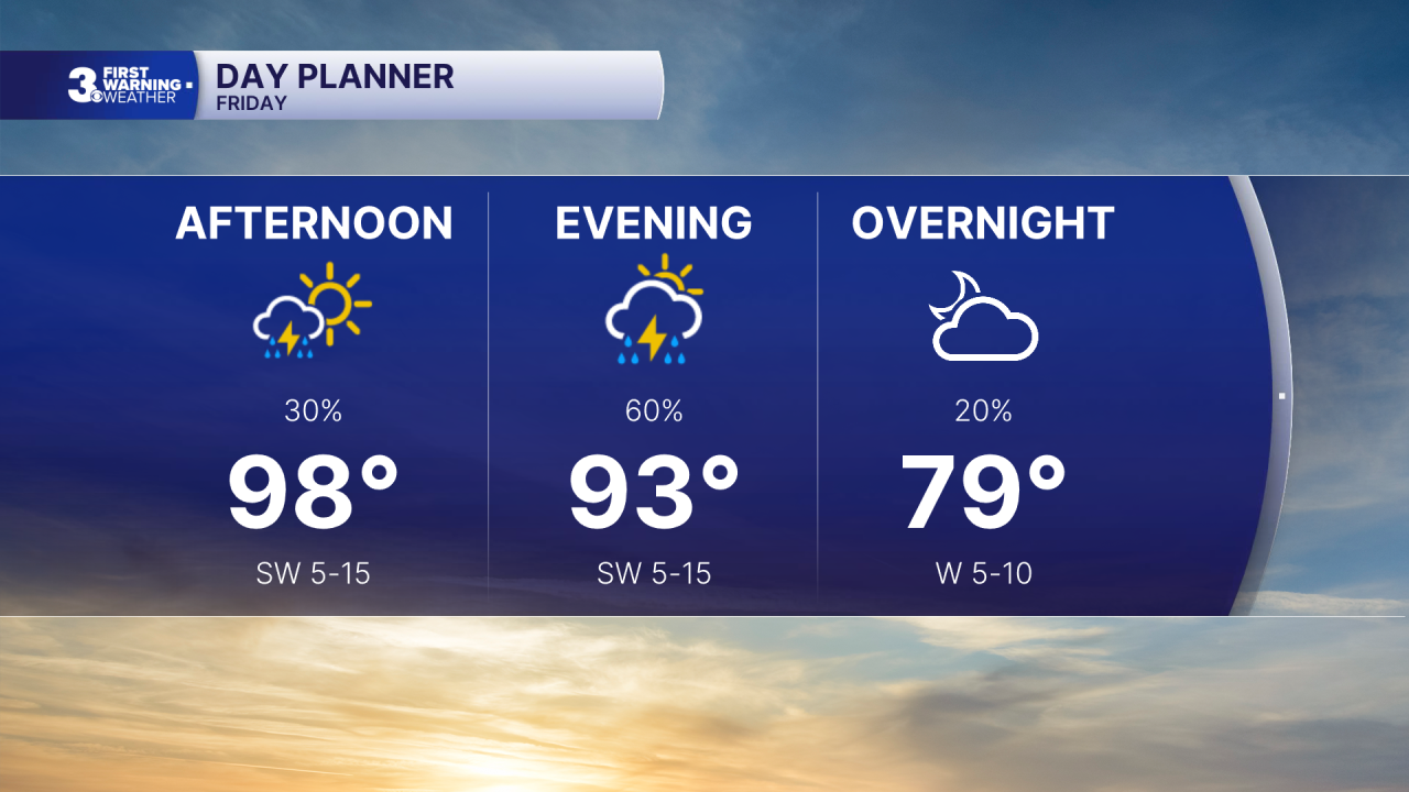
Another day of extreme heat and humidity. Highs will climb to the upper 90s today with an afternoon heat index to 105+. We will see a mix of mostly sunny to partly cloudy skies. Scattered showers/storms will develop this afternoon to evening. Some storms could be strong to severe with gusty winds and localized flooding.
Saturday will be the pick of the weekend. Highs will drop to the upper 80s with lower humidity. We will see a nice mix of sun and clouds with a smaller chance for rain.
The heat and humidity return for Sunday with highs in the mid 90s and an afternoon heat index to 100+. We will see partly cloudy skies with scattered showers/storms developing in the afternoon to evening. Strong to severe storms are possible.

Cooler and less humid air will move in to start next week. Expect highs in the 70s to 80s for the first half of the week.
Today: Sun & Clouds, Scattered Storms. Highs in the upper 90s. Winds: SW 5-15
Tonight: Partly Cloudy, Scattered Storms. Lows in the mid 70s. Winds: SW 5-10
Tomorrow: Sun & Clouds. Highs in the upper 80s. Winds: N/E 5-10
Weather & Health
Pollen: Moderate (Grasses)
UV Index: 10 (Extreme)
Air Quality: Moderate (Code Yellow)
Mosquitoes: Very High
Tropical Update
A broad area of low pressure is expected to form over the Yucatan Peninsula and the Bay of Campeche later today. Environmental conditions are forecast to be only marginally conducive for development before the system moves inland over eastern Mexico late Saturday or Sunday.
* Formation chance through 48 hours: Low (10%)
* Formation chance through 7 days: Low (10%)

Weather updates on social media:
Facebook: MylesHendersonWTKR
Instagram: @MylesHendersonWTKR
