




Meteorologist Myles Henderson’s First Warning Forecast
Heat, humidity, and storms to end the work week. A slight break in the heat this weekend.
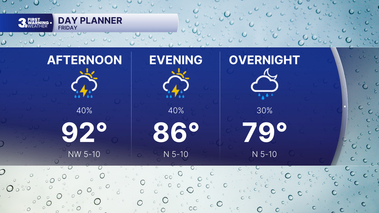
Hot and humid again today with highs in the low 90s and a heat index to 100+. Rain chances will increase today as a cold front moves through. Expect scattered showers and storms, mainly in the afternoon to evening. Strong to severe storms are possible with gusty winds and localized flooding.
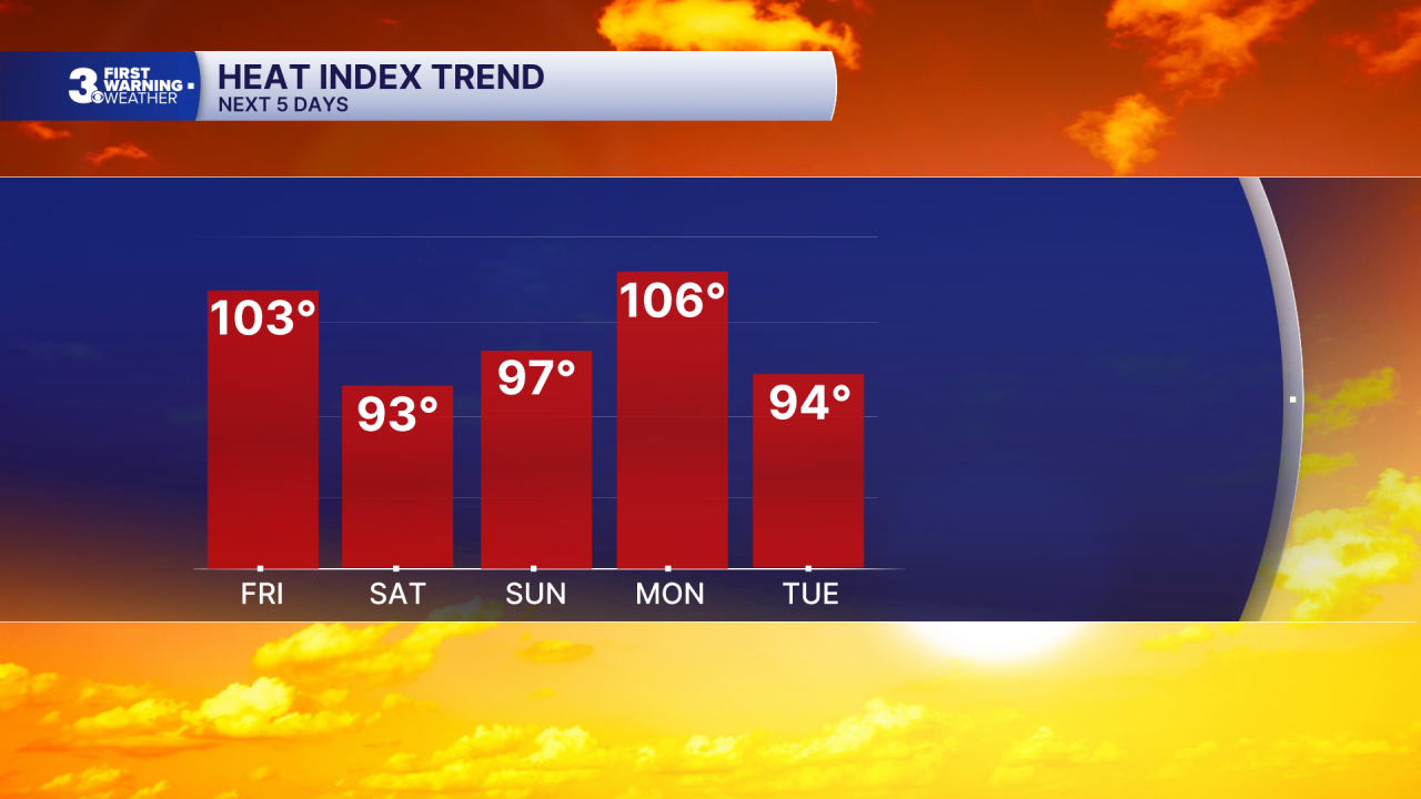
Highs will drop to mid and upper 80s this weekend, behind the cold front. We will see a mix of sun and clouds with an isolated shower/storm possible.
Heat, humidity, and storms return to start next week. Highs will climb to the mid 90s on Monday with ana afternoon heat index to 105+.
Today: Scattered Storms. Highs in the low 90s. Winds: S/N 5-10
Tonight: Scattered Storms. Lows in the mid 70s. Winds: N 5-10
Tomorrow: Partly Cloudy. Highs in the upper 80s. Winds: N/E 5-10
Weather & Health
Pollen: Medium-High (Ragweed, Grasses)
UV Index: 7 (High)
Air Quality: Moderate (Code Yellow)
Mosquitoes: Extreme
Tropical Update
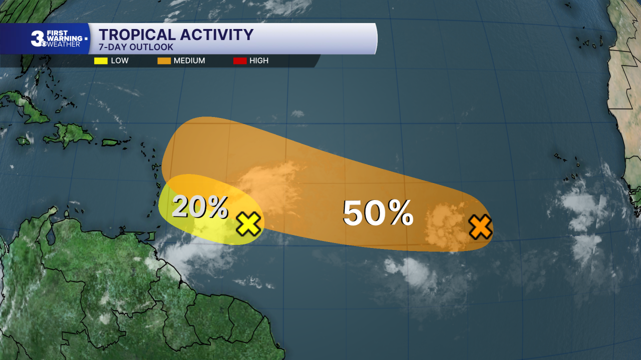
A tropical wave located about 400 miles east of the Windward Islands has continued to become less organized. This system is moving into a region of increasing upper-level winds and dry air, and the possibility of development is decreasing.
* Formation chance through 48 hours: Low (20%)
* Formation chance through 7 days: Low (20%)
Watching a tropical wave located several hundred miles SW of the Cabo Verde Islands. Environmental conditions are forecast to be generally conducive for some development, and a tropical depression could form late this week or this weekend while the wave moves WNW across the eastern and central tropical Atlantic.
* Formation chance through 48 hours: Low (30%)
* Formation chance through 7 days: Medium (50%)
Weather updates on social media:
Facebook: MylesHendersonWTKR
Instagram: @MylesHendersonWTKR
