


Meteorologist Myles Henderson’s First Warning Forecast
Cranking up the heat and humidity for the second half of the week. Several chances for scattered showers/storms to end the week.
Warmer with more humidity today. Highs will climb to the upper 80s, about 10 degrees warmer than yesterday. With the humidity it will feel more like the mid 90s this afternoon. We will see a mix of partly to mostly cloudy skies with scattered showers/storms possible.

Even more heat and humidity to end the work week. Highs will reach the mid 90s for Thursday and Friday with afternoon heat index values near 105. We will see a mix of mostly sunny to partly cloudy skies with a chance for scattered showers/storms each day. Some storms could be strong to severe with gusty winds and localized flooding.

A slight break for the weekend. Highs will drop to the upper 80s on Saturday, still above normal for this time of year. Highs will reach the low 90s on Sunday. Expect a mix of mostly sunny to partly cloudy skies with an isolated shower or storm possible.
Today: Mix of Clouds, Scattered Storms. Highs in the upper 80s. Winds: SW 10-15
Tonight: Mix of Clouds, Scattered Storms. Lows in the low 70s. Winds: SW 10-15
Tomorrow: Sun & Clouds, Scattered Storms. Highs in the mid 90s. Winds: SW 5-15
Weather & Health
Pollen: Low-Moderate (Grasses, Oak)
UV Index: 4 (Moderate)
Air Quality: Good (Code Green)
Mosquitoes: Very High
Tropical Update
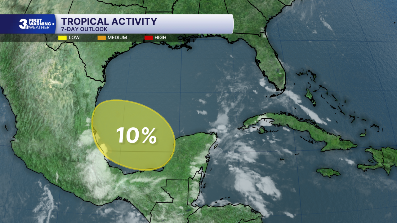
A broad area of low pressure could form over the Bay of Campeche late this week. Conditions are not expected to be favorable for significant development, and the system should move inland over eastern Mexico late this weekend.
Formation chance through 48 hours: Low (0%)
Formation chance through 7 days: Low (10%)
Weather updates on social media:
Facebook: MylesHendersonWTKR
Instagram: @MylesHendersonWTKR
