


Meteorologist Myles Henderson’s First Warning Forecast
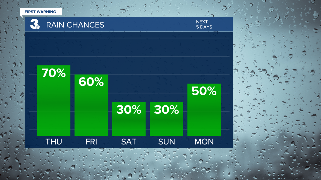
A summer-like stretch with heat, humidity, and afternoon storms. Several rain chances through the end of the week.
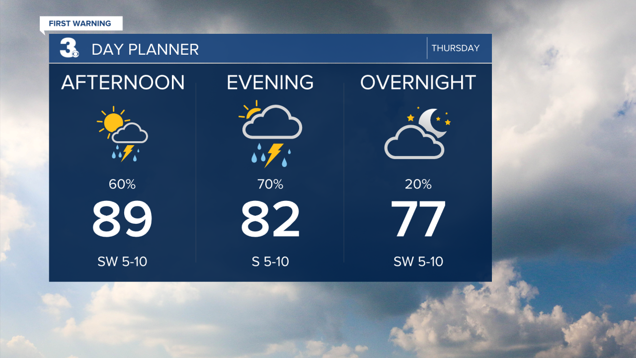
Highs will dip to the upper 80s today with an afternoon heat index in the upper 90s. We will see a mix of partly to mostly cloudy skies with scattered showers and storms mainly this afternoon to evening. Strong to severe storms are possible with damaging winds and a risk for localized flooding.
Highs will linger near 90 to end the work week. It will still be humid so the afternoon heat index will be in the upper 90s to low triple digits. Look for a mix of clouds again tomorrow with another round of showers and storms.
Not much change for the weekend. Highs will remain near 90 with an afternoon heat index near 100. Expect partly cloudy skies with scattered showers/storms possible. Rain chances will be slightly lower for the weekend and will increase again early next week.
Today: Scattered Storms. Highs in the upper 90s. Winds: SW 5-10
Tonight: Scattered Storms. Lows in the mid 70s. Winds: SW 5-10
Tomorrow: Scattered Storms. Highs near 90. Winds: S 5-10
Weather & Health
Pollen: Low (Grasses)
UV Index: 5 (Medium)
Air Quality: Good (Code Green)
Mosquitoes: Extreme
Tropical Update
No tropical activity at this time
Weather updates on social media:
Facebook: MylesHendersonWTKR
Instagram: @MylesHendersonWTKR
