


Meteorologist Myles Henderson’s First Warning Forecast
*** Heat Advisory for parts of NE NC from 11 am to 7 pm Friday.
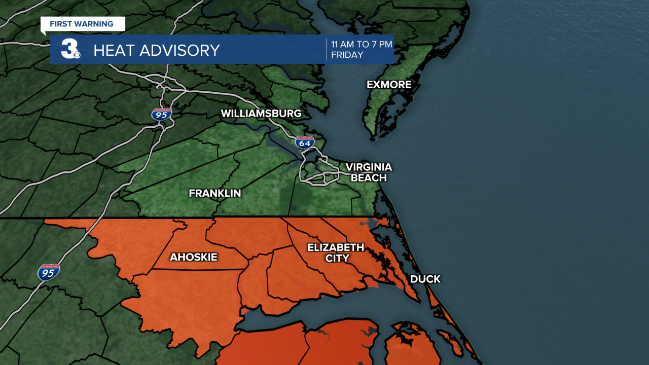
Heat index to 100+ through the weekend. Afternoon “pop up” showers/storms.
Highs will return to the mid 90s today with an afternoon heat index near 105. Expect partly cloudy skies with scattered showers/storms “popping up”, mainly in the afternoon hours. Strong to severe storms are possible.

Still hot and humid this weekend. Highs will linger in the mid 90s with an afternoon heat index near 105 both days. Most of the weekend will be mostly sunny to partly cloudy with a scattered shower/storm possible.

Rain chances will go up next week as a cold front moves in. Expect more showers and storms Tuesday to Wednesday. That front should also bring in a slight cool down for the second half of the week.

Today: Partly Cloudy. Highs in the mid 90s. Winds: S/SE 5-10
Tonight: Partly Cloudy. Lows in the upper 70s. Winds: S 5-10
Tomorrow: Partly Cloudy. Highs in the mid 90s. Winds: SW 5-10
Weather & Health
Pollen: Medium (Grasses)
UV Index: 10 (Very High)
Air Quality: Moderate (Code Yellow)
Mosquitoes: Extreme
Tropical Update
Watching a disturbance over the northwestern Caribbean Sea. Expected to move WNW into the Bay of Campeche Saturday, where a low-pressure area could form. Slow development is possible on Sunday or Monday if the system remains offshore of the coast of Mexico.
* Formation chance through 48 hours: Low (10%)
* Formation chance through 7 days: Low (20%)
Weather updates on social media:
Facebook: MylesHendersonWTKR
Instagram: @MylesHendersonWTKR
