


Meteorologist Myles Henderson’s First Warning Forecast
*** Extreme Heat Warning for most of SE VA and NE NC until 8 pm Wednesday.

Extreme heat continues. Several days with a heat index to 100+ this week.
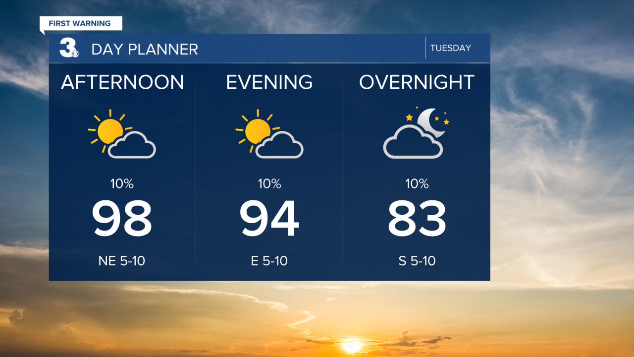
Highs will climb to the upper 90s today, 10 degrees above normal for this time of year. The heat index will climb to near 110 this afternoon for many locations. Expect mostly sunny skies to partly cloudy skies.
Highs will return to the upper 90s tomorrow with an afternoon heat index 105 to 110. Expect partly cloudy skies with scattered showers/storms “popping up”, mainly in the afternoon hours. Strong to severe storms are possible.
Highs will remain in the low to mid 90s for the second half of the week with afternoon heat index values at 100+. Expect partly cloudy skies with a scattered shower/storm possible.

Today: Partly Cloudy. Highs in the upper 90s. Winds: NW/NE 5-10
Tonight: Partly Cloudy. Lows in the upper 70s. Winds: E/S 5-10
Tomorrow: Partly Cloudy. Highs in the upper 90s. Winds: NW/NE 5-10
Weather & Health
Pollen: Medium (Grasses)
UV Index: 10 (Very High)
Air Quality: Moderate (Code Yellow)
Mosquitoes: Extreme
Tropical Update
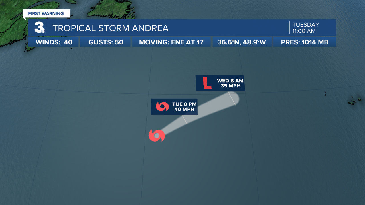
Tropical Storm Andrea forms in the open Atlantic about 1200 miles west of the Azores. Andrea is moving ENE and this motion is expected to continue for the next day or so. Maximum sustained winds are near 40 mph with higher gusts. Little change in strength is expected today. Weakening is expected to begin tonight, with Andrea dissipating by Wednesday night.
Weather updates on social media:
Facebook: MylesHendersonWTKR
Instagram: @MylesHendersonWTKR
