


Meteorologist Myles Henderson’s First Warning Forecast
Extreme heat and humidity for the holiday weekend. Bigger rain chances to start next week.
*** Extreme Heat Warning is in effect for SE VA and NE NC for Friday from 10 AM to 8 PM. Heat index values could hit 110+.
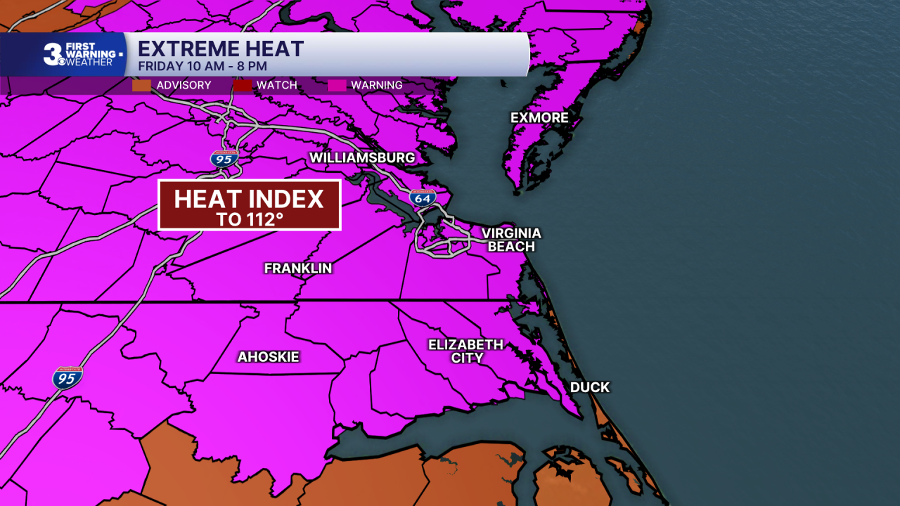
*** Heat Advisory is in effect for the Outer Banks on Friday from Noon to 8 PM. Heat index values could hit 105+.
Even hotter today with highs in the upper 90s, close to our record temperatures for this date. Afternoon heat index values will climb to near 110. Expect mostly sunny skies with a slim chance for a “pop-up” shower or storm.

The extreme heat and humidity continue for the holiday weekend. Expect mostly sunny to partly cloudy skies with highs in the upper 90s. Afternoon heat index values will reach to near 110. With all of the heat and humidity, a “pop-up” shower or storm is possible.

Bigger rain chances move in early next week with a cold front. Expect scattered showers and storms Monday, Tuesday, and Wednesday. Temperatures will drop to the 80s by midweek.
Today: Mostly Sunny. Highs in the upper 90s. Winds: SW 5-10
Tonight: Mainly Clear. Lows in the upper 70s. Winds: S 5-10
Tomorrow: Mostly Sunny. Highs in the upper 90s. Winds: S 5-10
Weather & Health
Pollen: Low-Medium (Grasses)
UV Index: 10 (Extreme)
Air Quality: Moderate (Code Yellow)
Mosquitoes: Extreme
Tropical Update
No tropical activity at this time.
Weather updates on social media:
Facebook: MylesHendersonWTKR
Instagram: @MylesHendersonWTKR
