

Derrah Getter's First Warning Forecast
The heat cranks up next week!
This evening will be very comfortable. Skies remain mostly clear with lows tonight in the upper 60s.

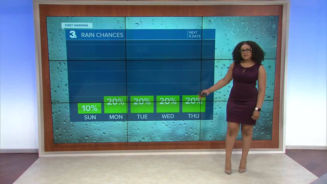
The gorgeous conditions continue Sunday with low rain chances and plenty of sunshine. Highest rain chances will be mainly confined to portions of the Outer Banks. Highs reach the low 80s.

We gradually get warmer next week. By Wednesday, high temperatures will be near 90 with heat index values in the mid 90s. There will be a slight chance for isolated showers and storms each day.

2025 Atlantic Hurricane Season Update:
As of 2pm
There are two disturbances in the tropics.
The first area is a tropical wave over the central Atlantic. Some gradual development is possible by the middle of next week.
Formation chance through 48 hours...Low...near 0%
Formation chance through 7 days...Low...20%
The second area is a broad area of low pressure off the west coast of Africa. A tropical depression could form mid to late next week.
Formation chance through 48 hours...Low...10%
Formation chance through 7 days...Medium...50%

Let's connect on social media!
Forecaster Derrah Getter:
For weather updates on Facebook: HERE
For weather updates on X: HERE
Follow me on Instagram: HERE
Check out the Interactive Radar on WTKR.com: Interactive Radar
