


Meteorologist Myles Henderson’s First Warning Forecast
Hot and humid again today. Cooling to the 70s with more clouds and rain to end the week.
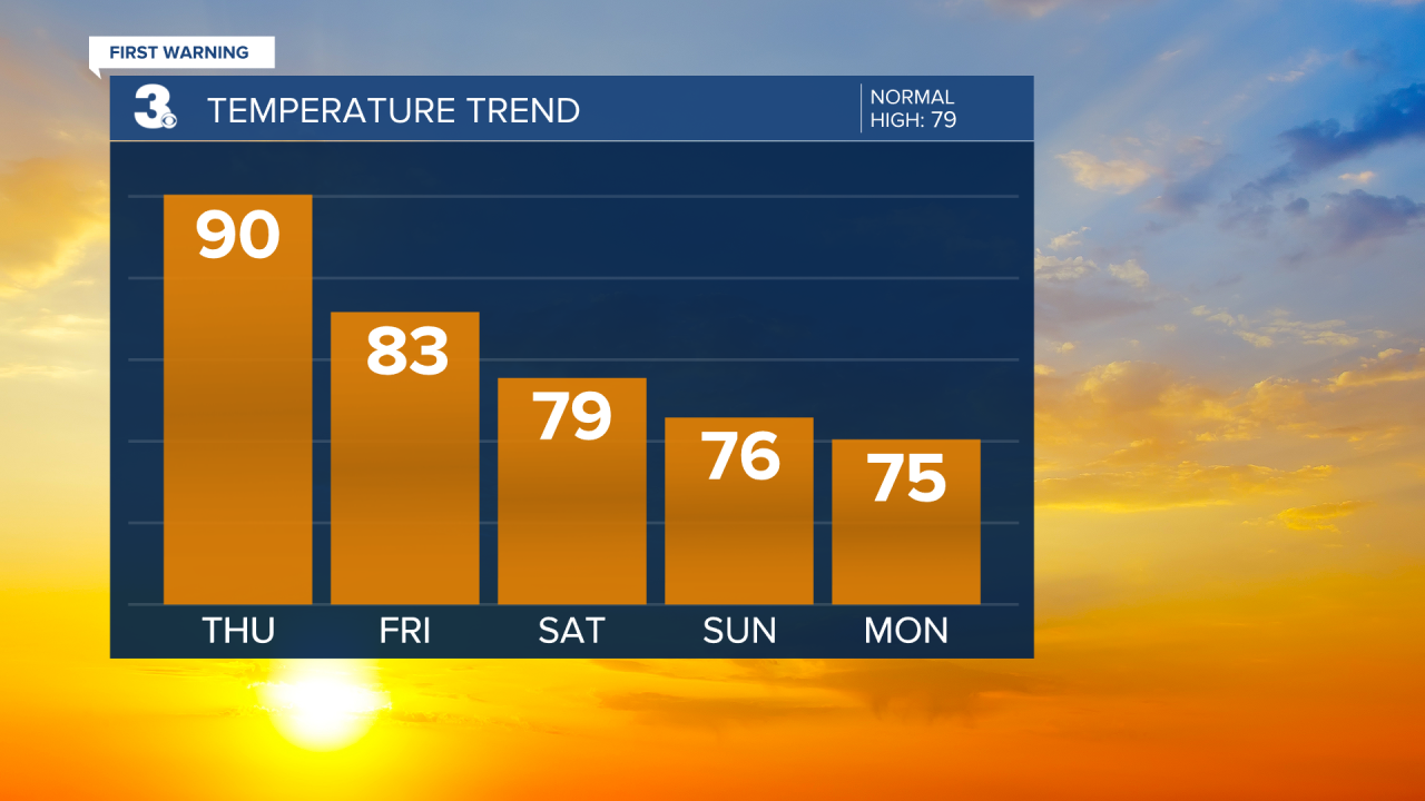
Warming to near 90 again today with high humidity, for this time of year. We will see a nice mix of mostly sunny to partly cloudy skies today. Scattered showers and storms will move in later today to tonight as a cold front approaches from the west. Strong to severe storms are possible mainly closer to I-95 (Central and Northern Virginia).

The cold front lingers over the Mid-Atlantic for the end of the week and the weekend, keeping us in a pattern of clouds and rain. Expect partly to mostly cloudy skies on Friday with scattered showers and storms. Highs will drop to the mid 80s tomorrow, but it will still be humid.
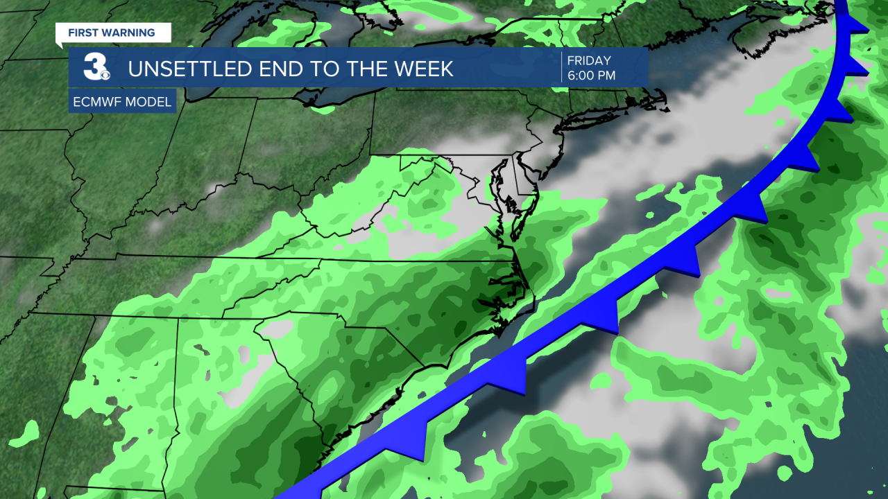
Expect mostly cloudy skies this weekend with scattered showers and isolated storms possible both days. Highs will drop to the mid and upper 70s, but it will still be muggy.
Today: Sun & Clouds. Highs near 90. Winds: SW 5-15
Tonight: Storm Late. Lows in the low 70s. Winds: SW 5-10
Tomorrow: Showers & Storms. Highs in the mid 80s. Winds: W/N/E 5-10
Weather & Health
Pollen: Low (Ragweed, Grasses)
UV Index: 7 (High)
Air Quality: Good (Code Green)
Mosquitoes: Very High
Tropical Update
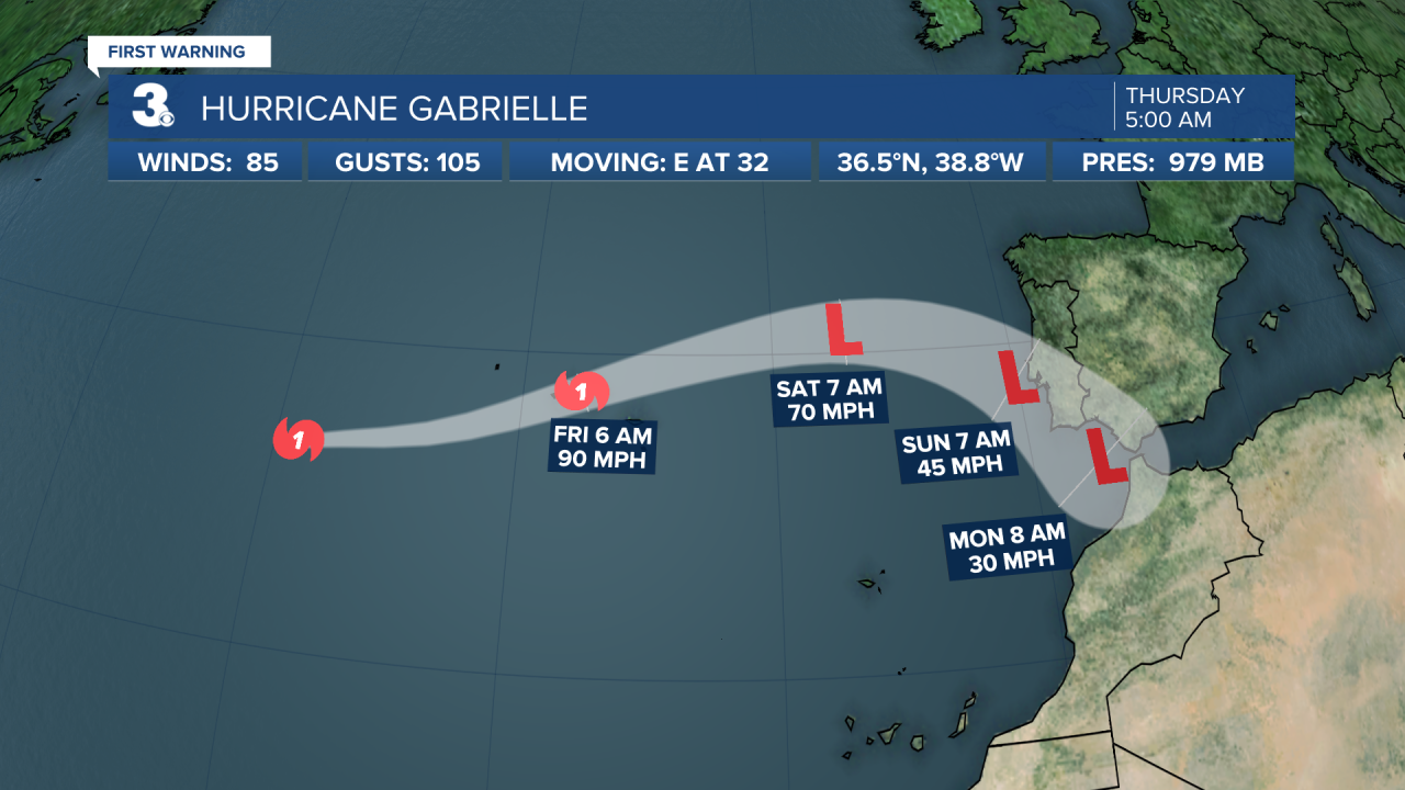
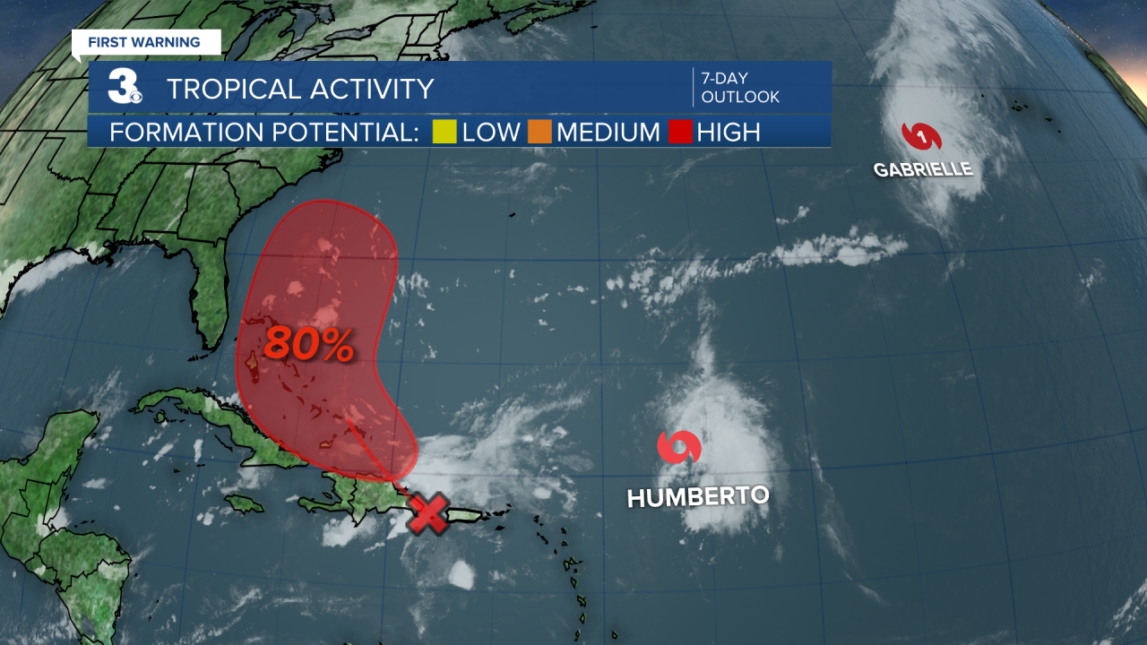
Hurricane Gabrielle is moving quickly toward the Azores. On the forecast track, the center of Gabrielle will approach the Azores today and move across the island chain tonight into early Friday. Gabrielle is forecast to be at hurricane strength when it passes through the Azores, then gradually weaken thereafter.
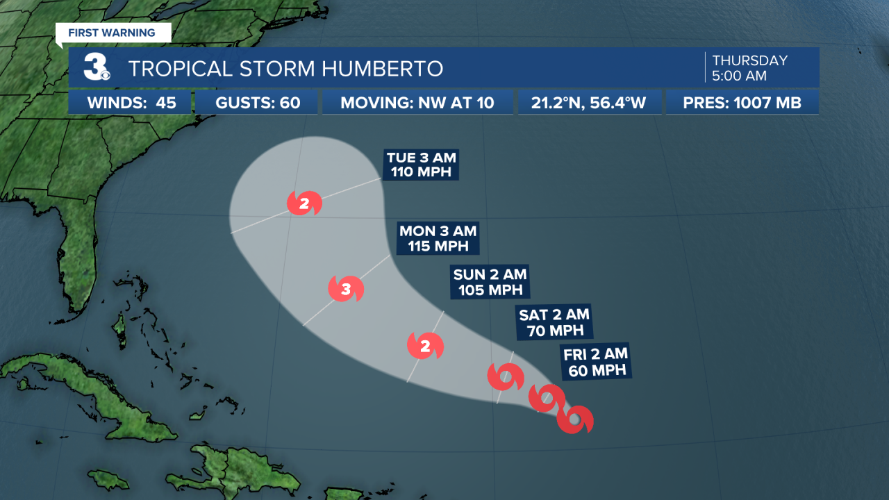
Tropical Storm Humberto is centered about 480 miles ENE of the northern Leeward Islands. A WNW to NW motion is expected over the next several days. Maximum sustained winds are near 45 mph with higher gusts. Steady strengthening is forecast during the next several days.
Tracking a tropical wave centered near the Dominican Republic. It is expected to move WNW, spreading heavy rainfall and gusty winds across Puerto Rico and the Dominican Republic through today. The system is then expected to slow down and turn NW when it reaches the southwestern Atlantic. A tropical depression is likely to form when the disturbance is in the vicinity of the Bahamas late this week.
* Formation chance through 48 hours: Medium (50%)
* Formation chance through 7 days: High (80%)
Weather updates on social media:
Facebook: MylesHendersonWTKR
Instagram: @MylesHendersonWTKR
