


Derrah Getter's First Warning Forecast
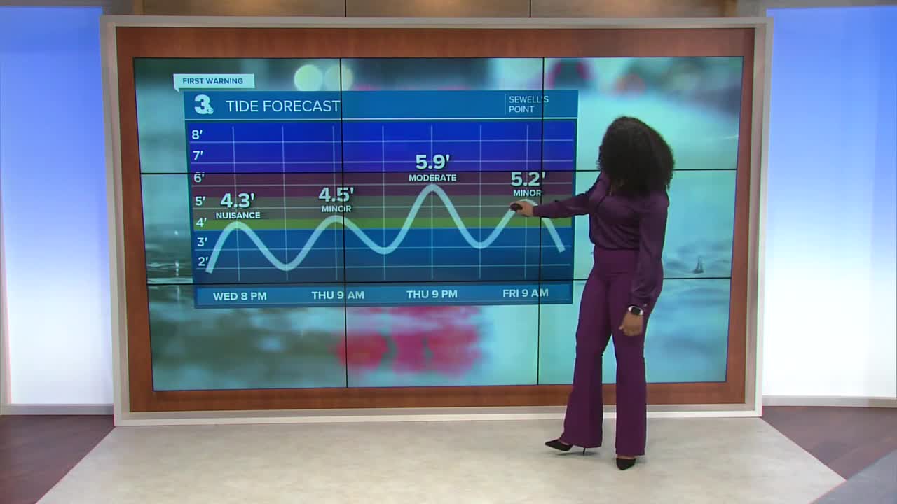
Minor to moderate tidal flooding persists this evening with mostly cloudy skies and a few spotty showers associated with a frontal boundary.

Temperatures tonight fall into the low 70s. The wind picks up overnight with gusts close to 60 mph along the Outer Banks by the morning and closer to 40 mph for Virginia Beach. Mostly cloudy skies linger all day Thursday with a few spotty showers. If you are inland, you can expect mainly clouds with highs in the low 80s and a light breeze. Erin will stay offshore so it won't be a huge rain maker for us but it will cause major flooding concerns.

The primary threats will be along the Outer Banks where periods of tropical downpours, strong wind and especially ocean over wash will take place. Storm surge can reach up to 5 ft along the immediate coast with wave heights up to 14 ft. Storm effects subside Friday morning with bright sunshine returning to the forecast through the weekend.

Beyond the weekend we're looking ahead to the below normal temperature trend continuing. Highs only reach the mid 70s by next Wednesday.

Let's connect on social media!
Forecaster Derrah Getter:
For weather updates on Facebook: HERE
For weather updates on X: HERE
Follow me on Instagram: HERE
Check out the Interactive Radar on WTKR.com: Interactive Radar
