




Meteorologist Myles Henderson’s First Warning Forecast
More fall-like this week with cooler temperatures and lower humidity.
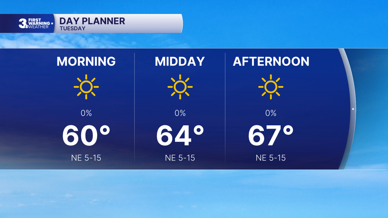
Lots of sunshine today with highs in the mid to upper 60s and lower humidity. Expect a bit of NE breeze at 5 to 15 mph.
Sunshine continues tomorrow with highs in the low 70s. Thursday will be the warmest day of the week with highs near 80. We will drop back to the 70s, near normal, for Friday.
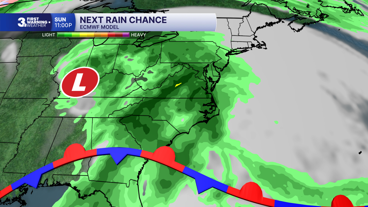
When it comes to our weekend forecast, all eyes are focused to the south. An area of low pressure in the Gulf could develop into a tropical system this week and move toward the U.S. Gulf Coast. That system will likely spread rainfall across the Southeast to Mid-Atlantic to end the weekend and start next week.
Today: Sunny. Highs in the upper 60s. Winds: NE 5-15
Tonight: Clear. Lows in the low 50s. Winds: E/SE 5-10
Tomorrow: Sunny. Highs in the low 70s. Winds: SE 5-10
Weather & Health
Pollen: Low-Medium (Ragweed)
UV Index: 5 (Medium)
Air Quality: Good (Code Green)
Mosquitoes: High
Tropical Update
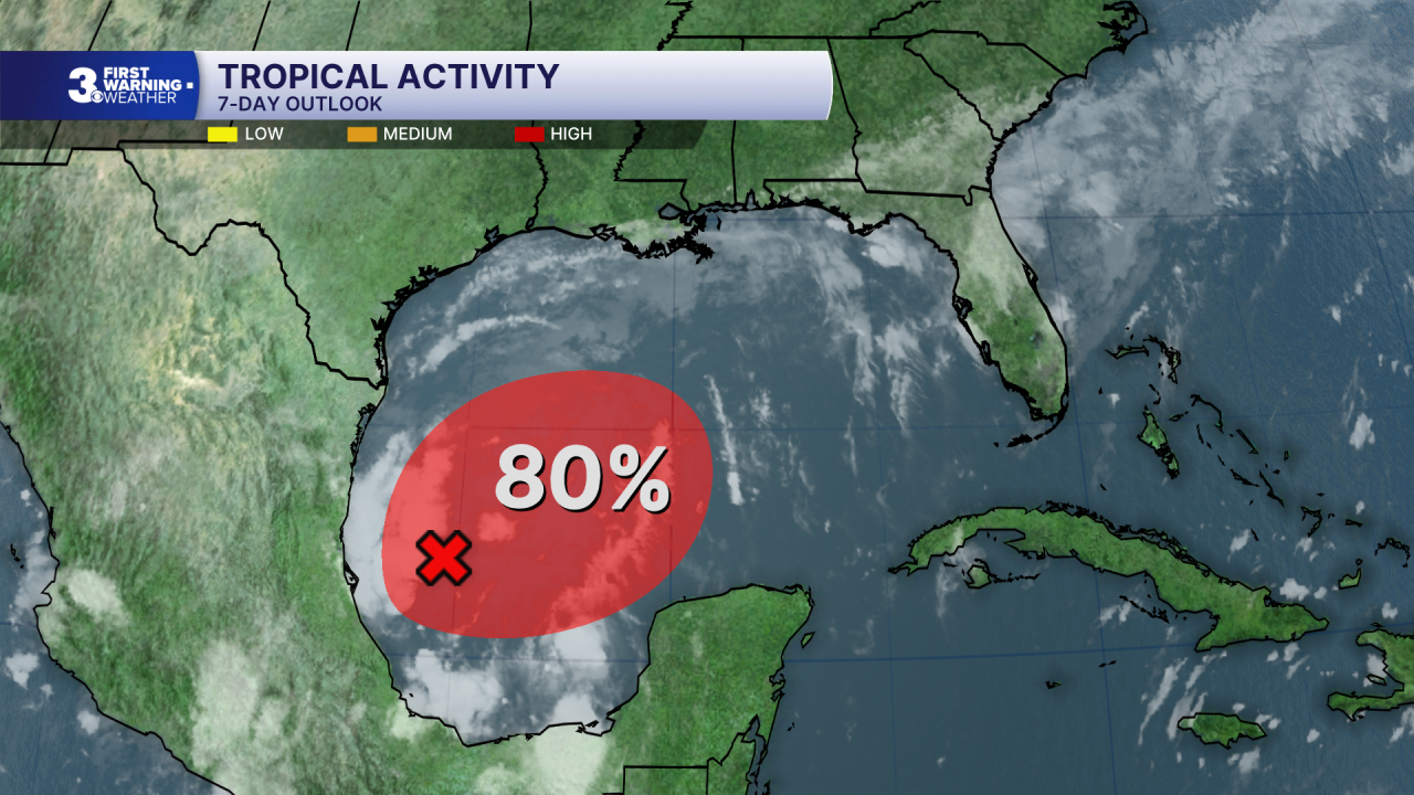
Tracking a trough of low pressure over the southwestern Gulf. A tropical depression is likely to form within the next couple of days. The system is expected to drift ENE through the middle portion of the week before turning north. It is too early to determine specific impacts to the northern Gulf Coast.
* Formation chance through 48 hours: High (80%)
* Formation chance through 7 days: High (80%)
Weather updates on social media:
Facebook: MylesHendersonWTKR
Instagram: @MylesHendersonWTKR
