


First Warning Forecast:
Wednesday will be the warmest day of the week. Highs will reach the mid 50s, about 5 degrees above normal for this time of year. Expect partly cloudy skies with a SW wind at 10 to 15 mph.
Rain will move in with a cold front Thursday morning but will change over to snow in the afternoon to evening as temperatures fall from the 40s to 30s.

Rain and snow chances will linger for Friday and Saturday as the front stalls and as low pressure develops and rides north up the coast.

How much are we talking about. Our longer-range computer forecast models are painting in upwards of 6-12 inches of snow between Thursday and Saturday.
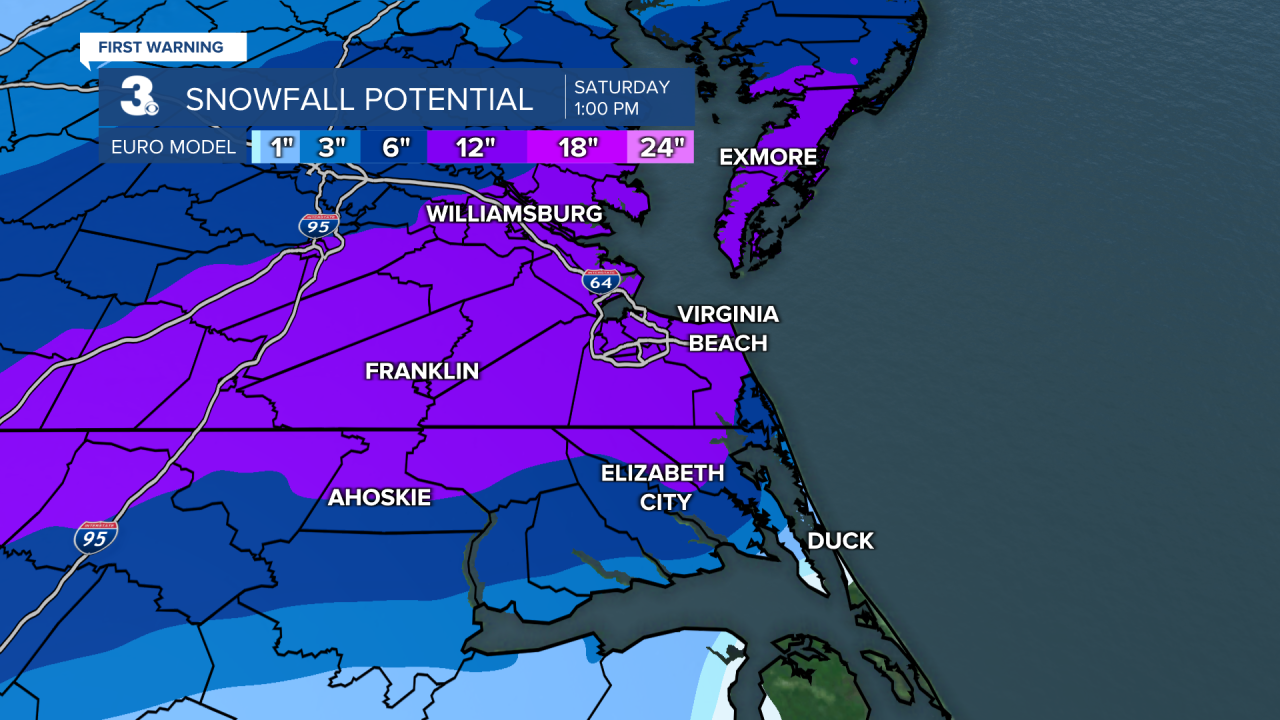

Is that set in stone? No. There are a number of factors that could change, including the track of our second storm system. But there are strong indications that we could be looking at our biggest snow in years. Stay tuned.
