


Derrah Getter's First Warning Forecast
This evening, skies remain mostly clear. It will be breezy with winds gusting up to 25 mph. Lows tonight will be in the 40s.

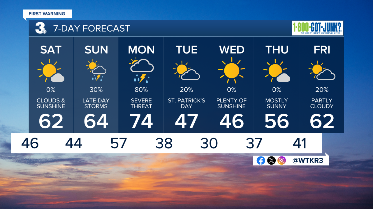
Saturday will be mostly sunny. A few clouds linger through the morning as a backdoor cold front approaches. Despite the approaching system, conditions are expected to remain dry. Highs will be in the 60s.
Sunday will be partly cloudy and mild. Highs will be slightly warmer than Saturday but will remain in the 60s. Isolated shower and storm chances return late Sunday night.

Scattered showers and storms return Monday. A strong cold front will bring the threat of severe weather. We’re currently under a level 3 out of 5 threat for numerous strong to severe thunderstorms. Damaging wind gusts are our main concern, but a few tornadoes can’t be ruled out.
Drier and cooler conditions return just in time for St. Patrick’s Day on Tuesday. Temperatures moderate back toward average by the end of next week.
Let's connect on social media!
Forecaster Derrah Getter:
For weather updates on Facebook: HERE
For weather updates on X: HERE
Follow me on Instagram: HERE
Check out the Interactive Radar on WTKR.com: Interactive Radar
