




Meteorologist Myles Henderson’s First Warning Forecast
Big temperature swings to end the week. Showers are possible Thursday and again to start the weekend. Much cooler and windy this weekend.
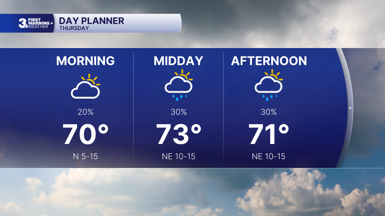
Cooler today with highs in the low to mid 70s, near normal for this time of year. We will see partly to mostly cloudy skies with a few scattered showers possible. Winds will shift to the NE and will increase to 10-15 mph.
Friday could be another record-setting day with highs in the mid to upper 80s. Expect sunshine through the day with clouds and rain building in Friday night with a cold front.
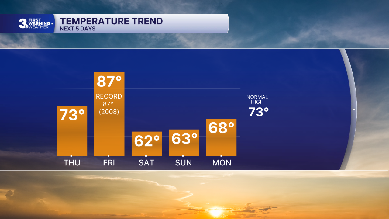
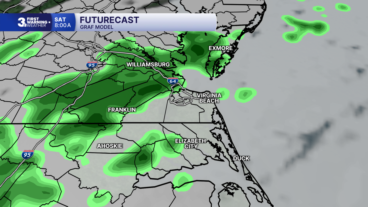
Temperatures will take a dive for the weekend. Expect highs in the low to mid 60s and overnight lows in the 40s and 50s. Saturday will start with clouds and showers, but sunshine will return for the afternoon. It will be windy this weekend, north at 15 to 25 with gusts to 35 mph on Saturday, NE at 10 to 20 with gusts to 30 on Sunday.
Today: More Clouds, Scattered Showers. Highs in the mid 70s. Winds: NE 5-15
Tonight: Mostly Cloudy. Lows in the mid 60s. Winds: E 5-15
Tomorrow: Back to Sunshine. Highs in the upper 80s. Winds: SW 5-15
Weather & Health
Pollen: Low-Medium (Ragweed)
UV Index: 1 (Low)
Air Quality: Good (Code Green)
Mosquitoes: High
Tropical Update
No tropical activity at this time
Weather updates on social media:
Facebook: MylesHendersonWTKR
Instagram: @MylesHendersonWTKR
