

Chief Meteorologist Patrick Rockey’s First Warning Forecast
This is the time of the year when you will hear me use the phrase “lather, rinse and repeat.” And for good reason.
Just about every day we expect high temperatures, high humidity and a chance for thunderstorms.
In fact, our hottest week of the year is on the way next week.
So enjoy the relatively mild weather on Saturday while it lasts.
We expect high temperatures in the mid 80s on Saturday. That is a few degrees below normal.
Scattered showers and thunderstorms will develop in the afternoon and into the evening, but the entire day will not be a washout.
Sunday features even lower rain chances but higher temperatures. It looks like we will top out around the 90° mark with a 30% chance for isolated showers and storms, mainly in the afternoon.
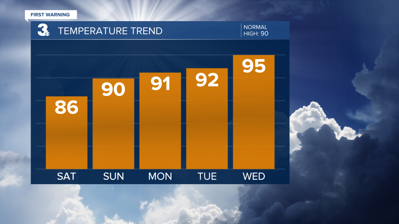
And Sunday marks the beginning of a long stretch of 90° weather.
Our hottest day over the next week appears to be Wednesday, with high temperatures in the mid 90s and heat index values between 100° and 105°.

After that, a frontal boundary moves in bringing us slightly lower temperatures and slightly higher chances for storms to end the next workweek.
