

A cloudy start to Friday with only spotty showers... Not as hot today with highs in the mid/upper 80s and some lower 90s.
Best shower and storm chances are this afternoon and evening with an isolated risk for strong/severe storms. Heavy rain and isolated higher wind gusts are possible impacts... Minor flooding may become a concern for some localized areas. An additional 1-2 inches of rainfall is possible on top of yesterday's rainfall totals of 1-3 inches.

Weekend Outlook: A dry start Saturday with the best shower and storm chances during the afternoon. The clouds and rain on Friday and Saturday will hold our temperatures down into the upper 80s and lower 90s, but the stifling heat and humidity will make another run early next week.
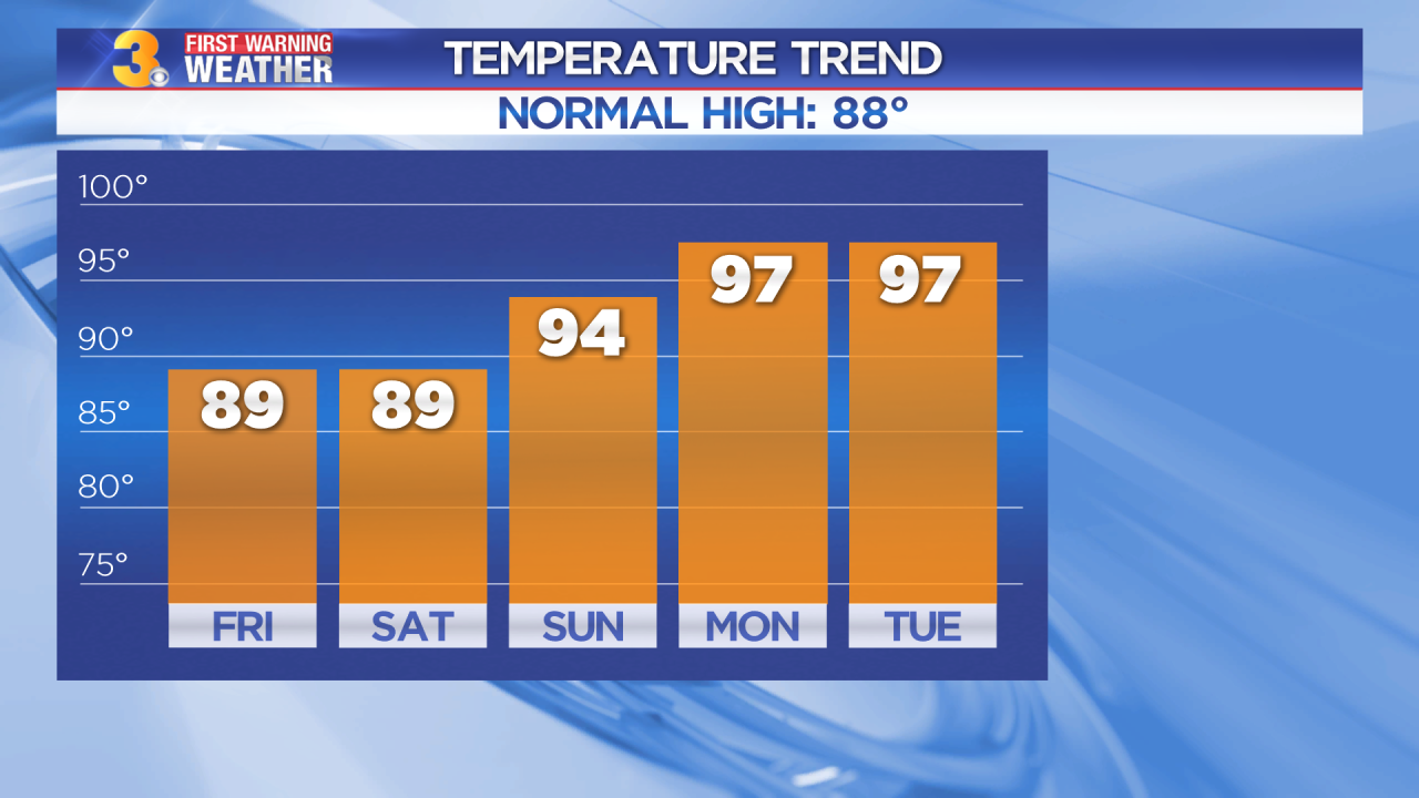
Triple-digit heat Monday and Tuesday as heat index values return to the 105 to 110 range.
