


Meteorologist Myles Henderson’s First Warning Forecast
A break from the heat and humidity to end the week. Another summer-like stretch next week.
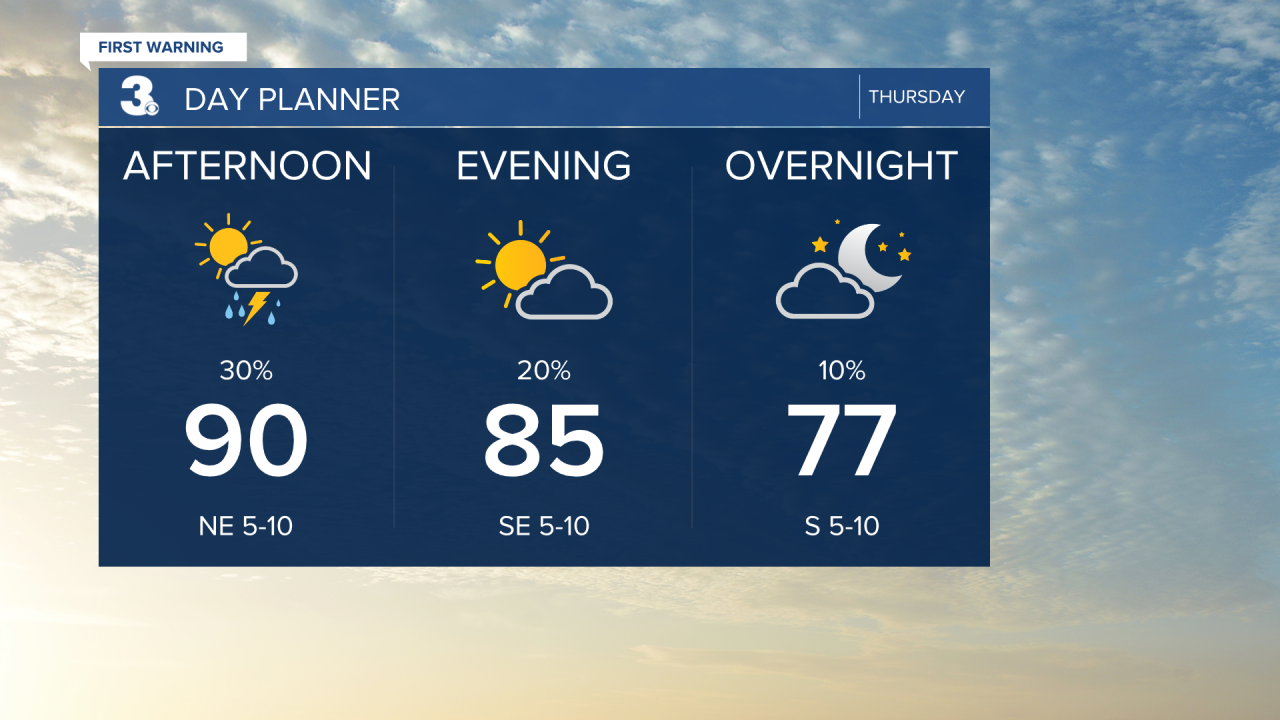
Highs will warm to the upper 80s this afternoon, near normal for this time of year. It will feel more like the mid to upper 90s with the humidity. Look for a nice mix of mostly sunny to partly cloudy skies with a “pop up” shower/storm possible this afternoon.
Very nice for Independence Day! Expect mostly sunny skies with high in the upper 80s and lower humidity.

Highs will remain in the upper 80s to low 90s this weekend. Expect mostly sunny skies on Saturday and partly cloudy skies on Sunday. The humidity will start to increase on Sunday with another chance for afternoon showers/storms.
Highs will linger in the low 90s next week with afternoon heat index values in the triple digits. Each day will have the chance for an afternoon shower or storm.

Today: Partly Cloudy. Highs near 90. Winds: W/N/E 5-10
Tonight: Partly Cloudy. Lows in the mid 70s. Winds: S 5-10
Tomorrow: Mostly Sunny. Highs in the upper 80s. Winds: W/N/E 5-10
Weather & Health
Pollen: Low-Moderate (Grasses)
UV Index: 10 (Very High)
Air Quality: Good (Code Green)
Mosquitoes: Extreme
Tropical Update
An area of low pressure is forecast to develop along a weakening frontal boundary near Florida early this weekend. Environmental conditions appear only marginally conducive for some slow development, but a tropical or subtropical depression could form in this region over the weekend or early next week while the system drifts northeast.
* Formation chance through 48 hours: Low (10%)
* Formation chance through 7 days: Medium (50%)

Weather updates on social media:
Facebook: MylesHendersonWTKR
Instagram: @MylesHendersonWTKR
