


Meteorologist Myles Henderson’s First Warning Forecast
More sunshine and not as cold to end the work week. A quick warming trend this weekend.
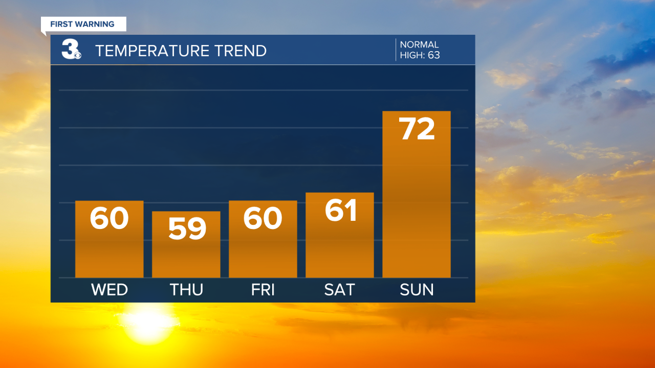
Starting this morning in the 40s and 30s. Lots of sunshine today with highs warming to near 60, about 15 degrees warmer than yesterday. It will still be windy today, SW at 10 to 20 with gusts to 30 mph.

We will see a mix of sun and clouds tomorrow, more clouds in the morning and more sun in the afternoon. Highs will reach the upper 50s with a NW wind at 10 to 15 mph.
Friday may be the pick of the week. Highs will return to near 60 with lots of sunshine and light wind.
A quick warming trend over the weekend. Highs will jump from the low 60s on Saturday to the low 70s on Sunday. Expect a mix of sun and clouds with a spotty shower possible as a series of front track across the region.
Today: Mostly Sunny, Windy. Highs near 60. Winds: SW 10-20 G30
Tonight: Mainly Clear. Lows in the mid 40s. Winds: W 5-15
Tomorrow: Partly Cloudy to Mosty Sunny. Highs in the upper 50s. Winds: NW 10-15
Weather & Health
Pollen: Low
UV Index: 3 (Moderate)
Air Quality: Good (Code Green)
Mosquitoes: Low
Tropical Update
No tropical activity at this time
Weather updates on social media:
Facebook: MylesHendersonWTKR
Instagram: @MylesHendersonWTKR
