


Meteorologist Myles Henderson’s First Warning Forecast
The rest of the week will be much cooler with several chance for rain.
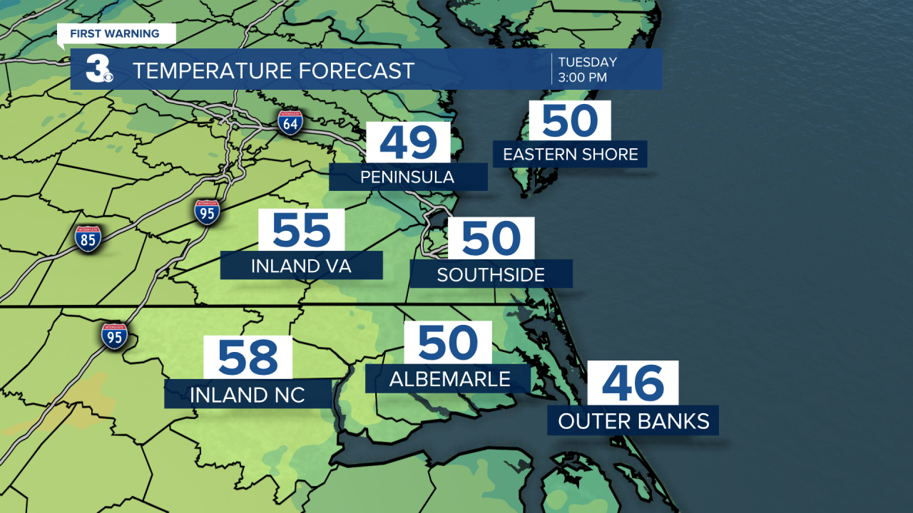
Temperatures are falling early this morning from the 60s to the 40s. We will linger in the low 50s most of the day, about 30 degrees cooler than yesterday afternoon. Leftover clouds this morning will clear out as winds back down through the day.
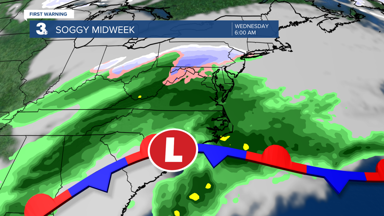
Wednesday will be a soggy day as a stationary front and area of low pressure linger along the Carolina coast. Expect overcast skies with widespread rain, mainly in the morning. Rain will become more scattered by the afternoon. Highs will return to near 50 degrees. Clouds and scattered showers will linger for Thursday, with the biggest chance for rain in North Carolina.
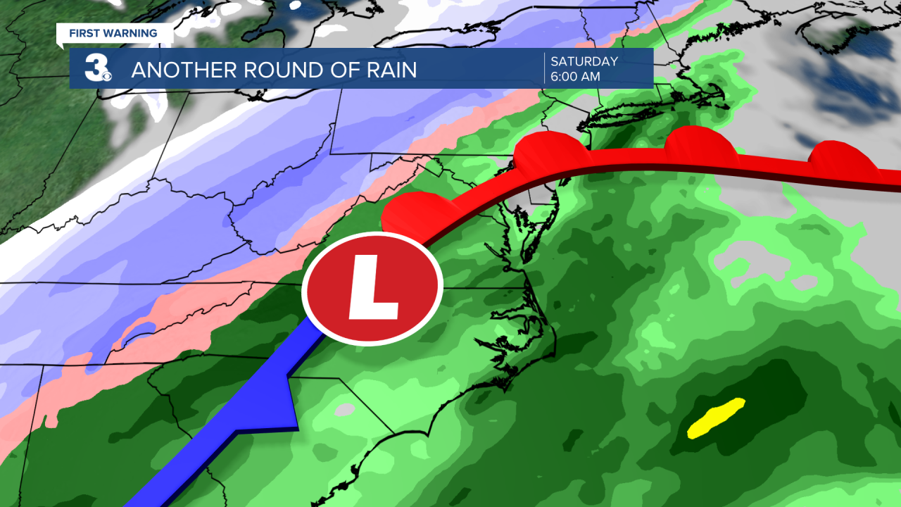
We are tracking a cold front that will bring us another round of rain Friday night to Saturday morning. Temperatures drop from the 60s on Saturday to the 40s on Sunday behind the cold front.
Today: Clearing Skies, Cooler. Highs in the low 50s. Winds: NE 5-15
Tonight: Partly Cloudy, Showers Late. Lows in the mid 40s. Winds: E 5-10
Tomorrow: Cloudy, Rain, Breezy. Highs near 50. Winds: NE 10-15
Weather & Health
Pollen: Medium-High (Juniper, Maple, Ash)
UV Index: 6 (High)
Air Quality: Good (Code Green
Mosquitoes: Moderate
Weather updates on social media:
Facebook: MylesHendersonWTKR
Twitter: @MHendersonWTKR
Instagram: @MylesHendersonWTKR
