


Meteorologist Myles Henderson’s First Warning Forecast
A very warm week with highs in the 80s to near 90. Tracking our next rain chance for Sunday.
Mild again this morning with temperatures in the upper 60s. Another step warmer today with highs near 90 degrees, close to our record high temperatures for this date. Expect mostly sunny skies with a bit of a SW breeze.

Highs will return to the upper 80s tomorrow, still almost 20 degrees above normal for this time of year. Expect partly cloudy skies with a SW wind at 10 to 15 mph.
Expect partly cloudy skies on Friday with a slim rain chance and highs in the mid 80s.
Saturday looks like the pick of the weekend with mostly sunny to partly cloudy skies and highs in the mid 80s. Our next chance for rain is set to move in Sunday afternoon with a cold front.

Much cooler air will move in early next week, behind the cold front. Expect highs in the low to mid 60s to start the work week.
Today: Mostly Sunny. Highs near 90. Winds: SW 5-15
Tonight: Mainly Clear. Lows in the upper 60s. Winds: SW 5-15
Tomorrow: Partly Cloudy, Breezy. Highs in the upper 80s. Winds: SW 10-15
Weather & Health
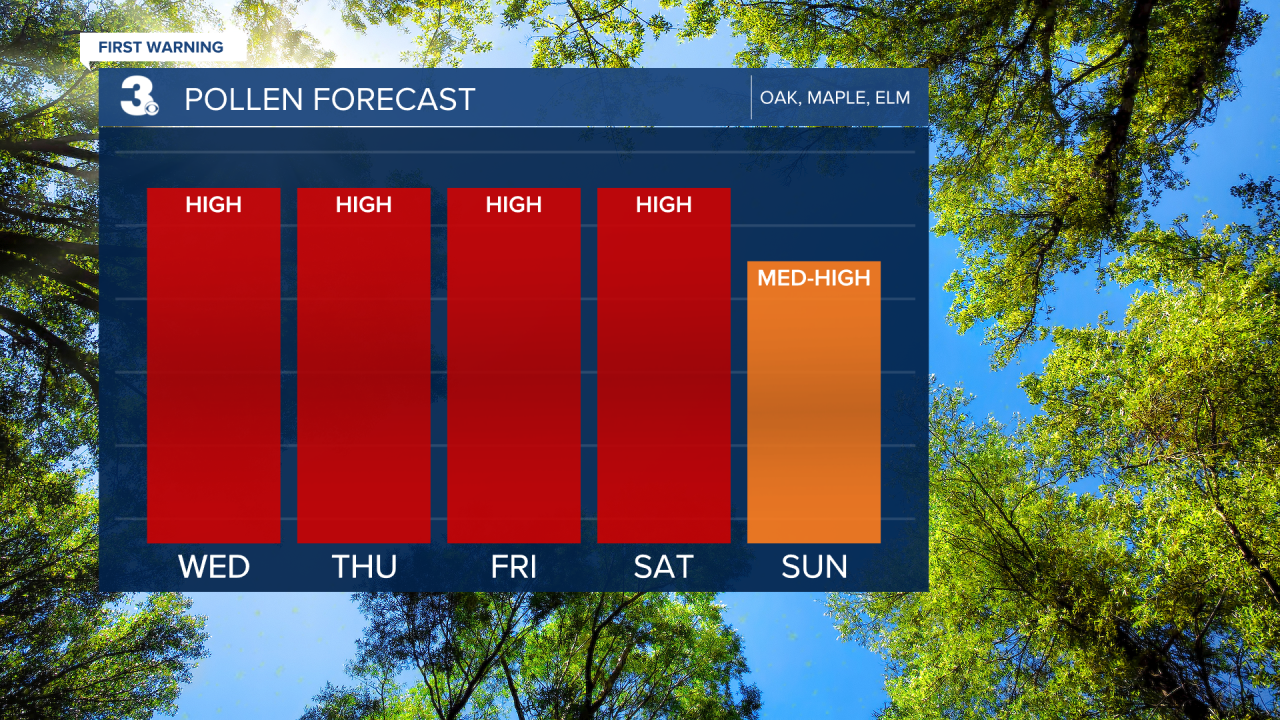
Pollen: High (Oak, Maple, Elm)
UV Index: 8 (High)
Air Quality: Moderate (Code Yellow)
Mosquitoes: Moderate
Weather updates on social media:
Facebook: MylesHendersonWTKR
Instagram: @MylesHendersonWTKR
