


Chief Meteorologist Patrick Rockey’s First Warning Forecast
We have enjoyed some spectacular weather during the last weekend of spring. But summer is starting and soon it will feel like it.
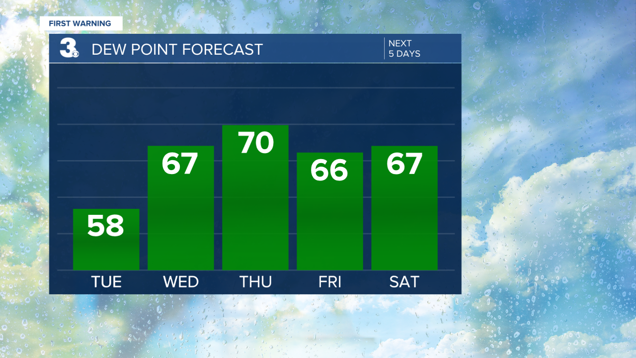
It will be a little warmer and a little more humid for the first day of summer on Tuesday, but still pretty comfortable.
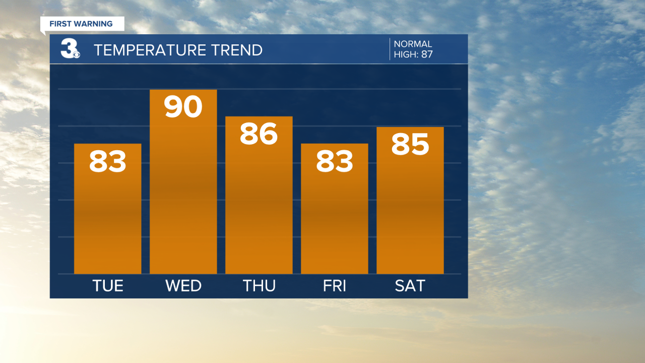
However, a warm front will push through on the first full day of summer on Wednesday.
It is going to be hot and muggy and will likely end with thunderstorms in the evening hours.
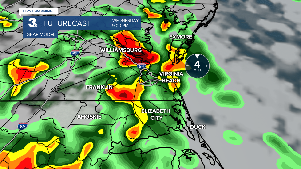
A few of those storms could be severe and produce some heavy downpours.
Before the rain gets here expect high temperatures in the upper 80s and lower 90s with heat index values in the mid 90s.
Thursday will be even steamier but not quite as hot. Expect high temperatures in the mid to upper 80s with about a 30% chance for an afternoon storm.
Our temperatures continue to ease on Friday. Under partly cloudy skies, expect high temperatures in the low-to-mid 80s.
But we will be warming back up just in time for the weekend. We will top out in the mid 80s on Saturday and the upper 80s on Sunday with a 20% chance for a pop-up shower or storm both days.
