


Meteorologist Myles Henderson’s First Warning Forecast
More nice weather for Labor Day. Warming back to the 80s and building humidity this week.
Our nice stretch of weather continues. Highs in the upper 70s today, below normal for this time of year. We will see partly cloudy skies with a slim chance for a shower. The biggest issue today with be the wind, NE at 10 to 15 and stronger near the water.

The wind will back down for Tuesday with partly cloudy skies and low rain chances. Highs will return to the upper 70s.
The temperature and humidity will gradually build through the week. Highs will climb to near 80 on Wednesday, to the mid 80s Thursday and Friday. Isolated showers are possible Thursday/Friday as a cold front moves through.

We will see a better chance for showers this weekend with another cold front set to move through.
Today: Partly Cloudy, Breezy. Highs in the upper 70s. Winds: NE 10-15
Tonight: Partly Cloudy. Lows in the mid 60s. Winds: NE 5-10
Tomorrow: Partly Cloudy. Highs in the upper 70s. Winds: NE 5-10
Weather & Health
Pollen: High (Ragweed, Grasses)
UV Index: 8 (High)
Air Quality: Good (Code Green)
Mosquitoes: Very High
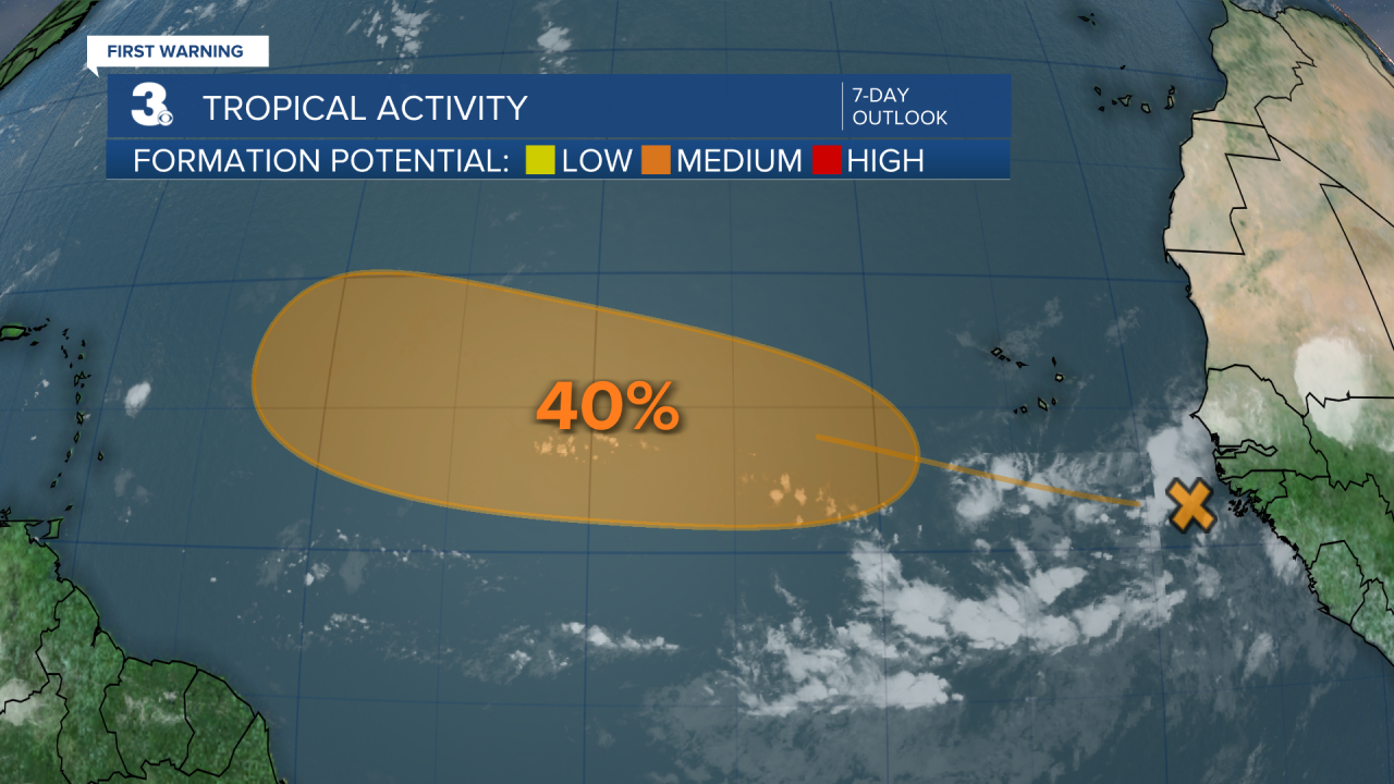
Tropical Update
Tracking a tropical wave located over the far eastern tropical Atlantic. Environmental conditions appear conducive for slow development of this system, and a tropical depression could form late this week or next weekend. This system is expected to move west to WNW across the eastern and central tropical Atlantic throughout the week.
* Formation chance through 48 hours: Low (0%)
* Formation chance through 7 days: Medium (40%)
Weather updates on social media:
Facebook: MylesHendersonWTKR
Instagram: @MylesHendersonWTKR
