


Meteorologist Myles Henderson’s First Warning Forecast
Our fall-like stretch continues through midweek. Warming back to the 80s and building humidity to end the week.
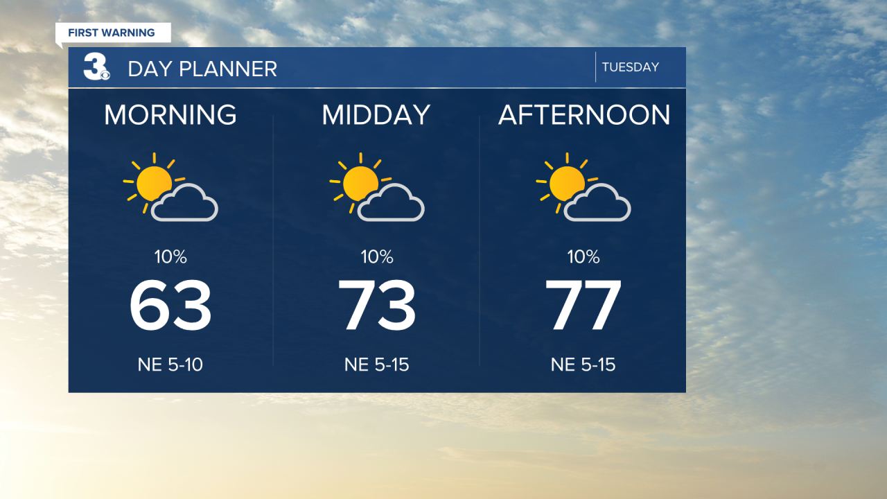
Another nice day today. Highs with return to the upper 70s today, below normal for this time of year, with low humidity. We will see partly cloudy skies with a slim chance for a shower.
The temperature and humidity will gradually build through the week. Highs will climb to the mid 80s Thursday and near 90 on Friday.
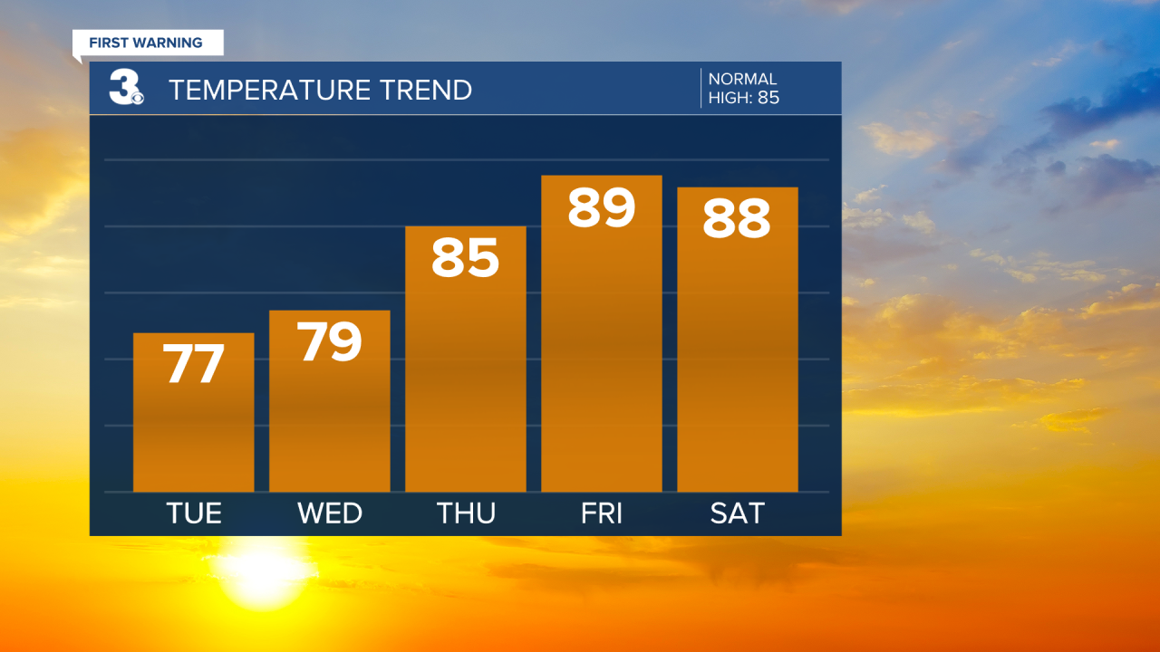
We will see a better chance for showers this weekend as a cold front moves through. Expect partly cloudy skies with scattered showers. Highs will reach the upper 80s on Saturday, then dip to the upper 70s on Sunday, behind the front.
Today: Partly Cloudy. Highs in the upper 70s. Winds: NE 5-15
Tonight: Partly Cloudy. Lows in the mid 60s. Winds: NE 5-10
Tomorrow: Mostly Sunny. Highs in the upper 70s. Winds: NE 5-10
Weather & Health
Pollen: Medium-High (Ragweed, Grasses)
UV Index: 7 (High)
Air Quality: Good (Code Green)
Mosquitoes: Very High
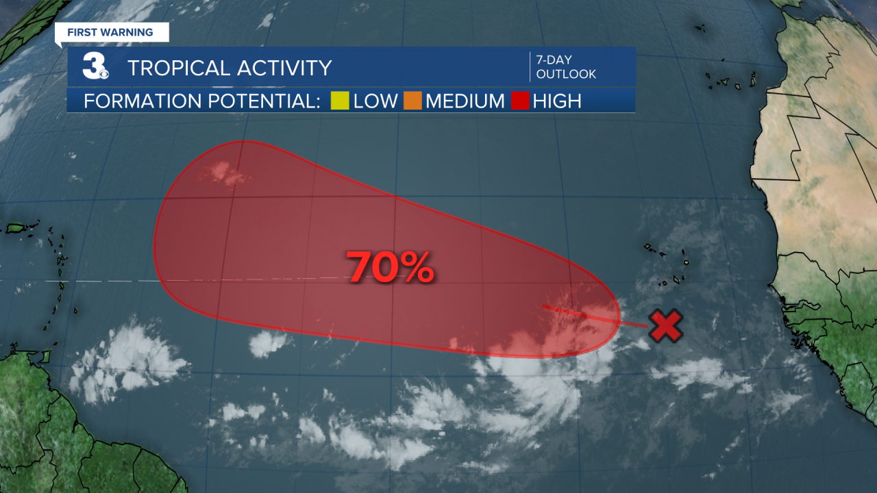
Tropical Update
Tracking a tropical wave located over the far eastern tropical Atlantic south of the Cabo Verde islands. Environmental conditions appear conducive for gradual development of this system during the next several days, and a tropical depression is likely to form later this week or this weekend. This system is expected to move west to WNW across the eastern and central tropical Atlantic throughout the week.
* Formation chance through 48 hours: Low (30%)
* Formation chance through 7 days: High (70%)
Weather updates on social media:
Facebook: MylesHendersonWTKR
Instagram: @MylesHendersonWTKR
