


Meteorologist Myles Henderson’s First Warning Forecast
Another nice day…We will see more sunshine today with a few clouds mixing in. Highs will return to the mid 40s, about 5 degrees below normal for this time of year.
We will warm to the mid 50s on Wednesday with a mix of sun and clouds. Thursday will be the warmest day of the week with highs in the mid 60s. Expect mostly cloudy skies with a spotty shower possible.
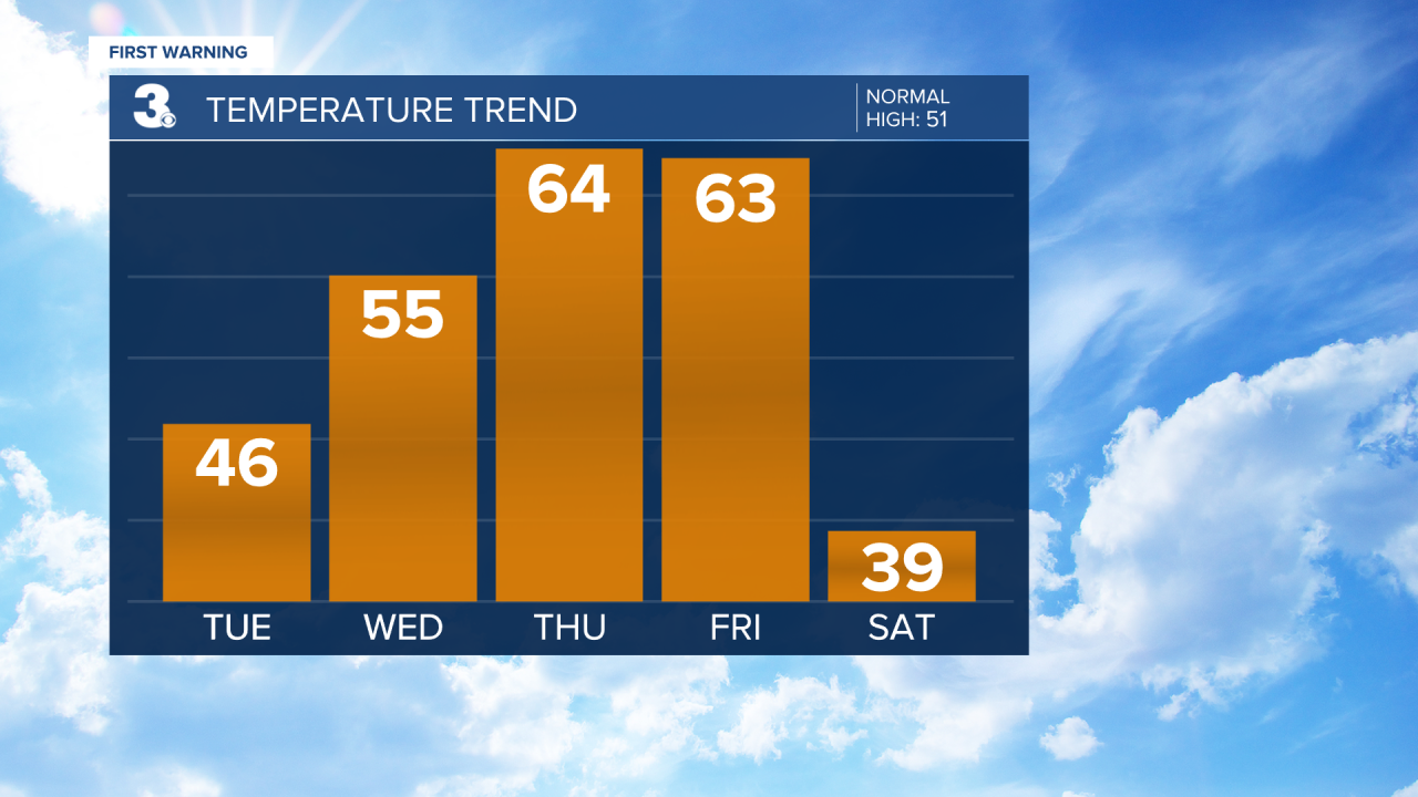
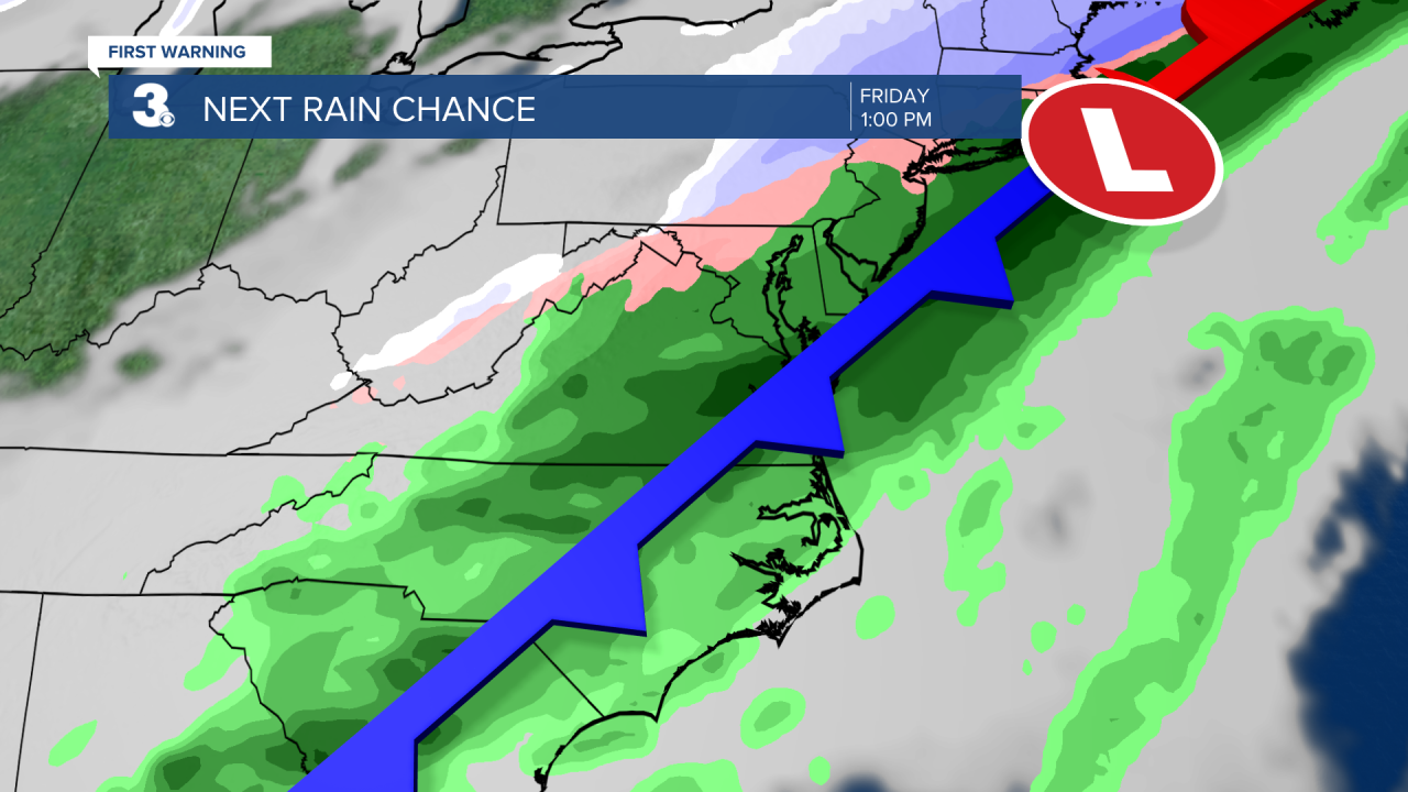
Friday will be our soggy day this week. Expect mostly cloudy skies with rain showers for most of day as a cold front moves through. Winds will ramp up and turn from SW to north as the front moves through. Highs will drop from the 60s on Friday to the upper 30s on Saturday, behind the cold front.
Today: A Few Clouds. Highs in the mid 40s. Winds: NE 5-15
Tonight: Partly Cloudy. Lows in the mid 30s. Winds: NE 5-10
Tomorrow: Partly Cloudy. Highs in the mid 50s. Winds: NE 5-10
Weather updates on social media:
Facebook: MylesHendersonWTKR
Twitter: @MHendersonWTKR
Instagram: @MylesHendersonWTKR
