


Meteorologist Myles Henderson’s First Warning Forecast
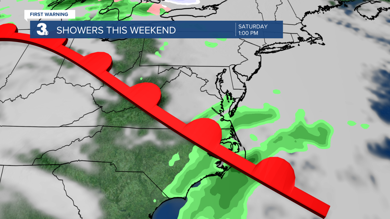
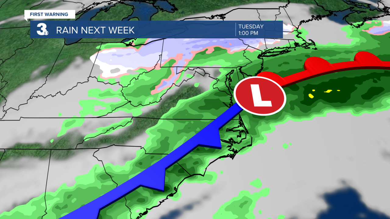
The temperature roller coaster continues as we drop to the 40s on Friday then warm to near 80 on Monday. Watching a few showers for the weekend with a bigger rain chance with a cold front on Tuesday.
Another nice day! We will warm to the mid 60s this afternoon, about 10 degrees above normal for this time of year. Expect lots of sunshine today with light and variable winds. Highs will return to the 60s on Thursday with clouds building in.
A cold front will move through the region Thursday to Friday. Rain chances will be slim, but we will see extra clouds and a temperature drop. Expect highs in the upper 40s on Friday.
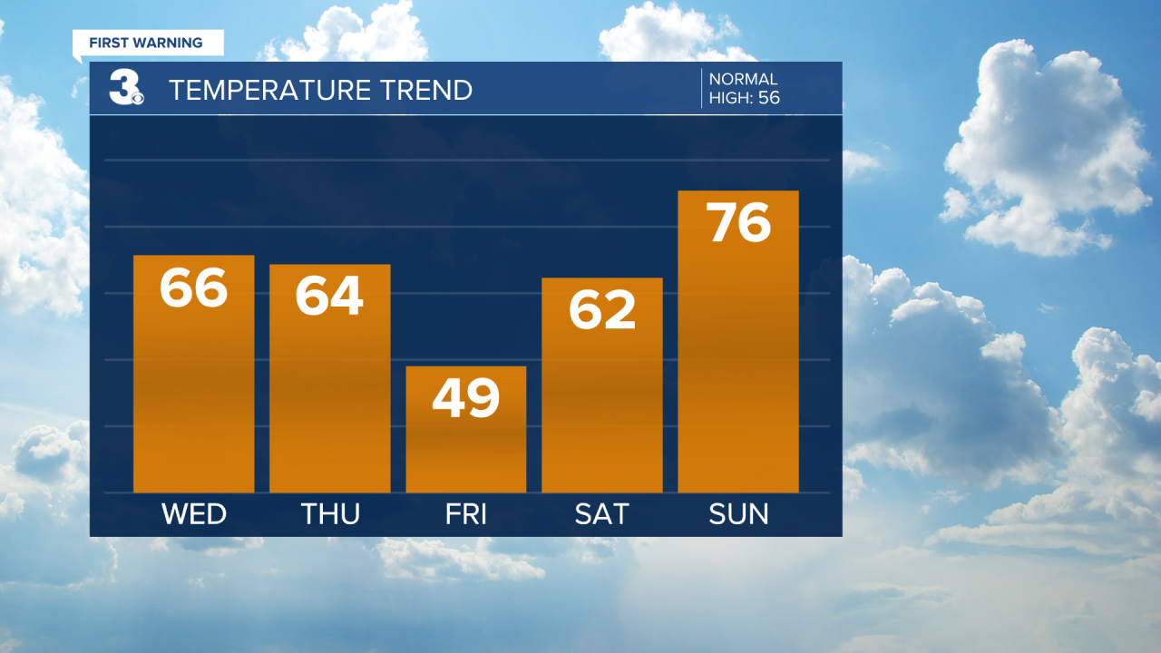
We will warm back to the 60s and 70s this weekend as a warm front lifts through from south to north. The front will bring in extra clouds (partly to mostly cloudy skies) and the chance for a few spotty showers.
It will be warm and windy on Monday with highs near 80, 25 degrees above normal for this time of year. A cold front will bring in a bigger rain chance and another temperature drop on Tuesday.
Today: Sunny Skies. Highs in the mid 60s. Winds: W/N/E 5-10
Tonight: Mainly Clear. Lows in the upper 40s. Winds: S 5-10
Tomorrow: Partly Cloudy. Highs in the mid 60s. Winds: W/N 5-15
Weather & Health
Pollen: Medium-High (Juniper, Elm, Maple)
UV Index: 5 (Moderate)
Air Quality: Good (Code Green
Mosquitoes: Low
Weather updates on social media:
Facebook: MylesHendersonWTKR
Twitter: @MHendersonWTKR
Instagram: @MylesHendersonWTKR
