


Meteorologist Myles Henderson’s First Warning Forecast
More sunshine for the weekend. Heat, humidity, and storms return to start next week.
A nice evening with temperatures falling from the 80s to the 70s with a mix of sun and clouds.
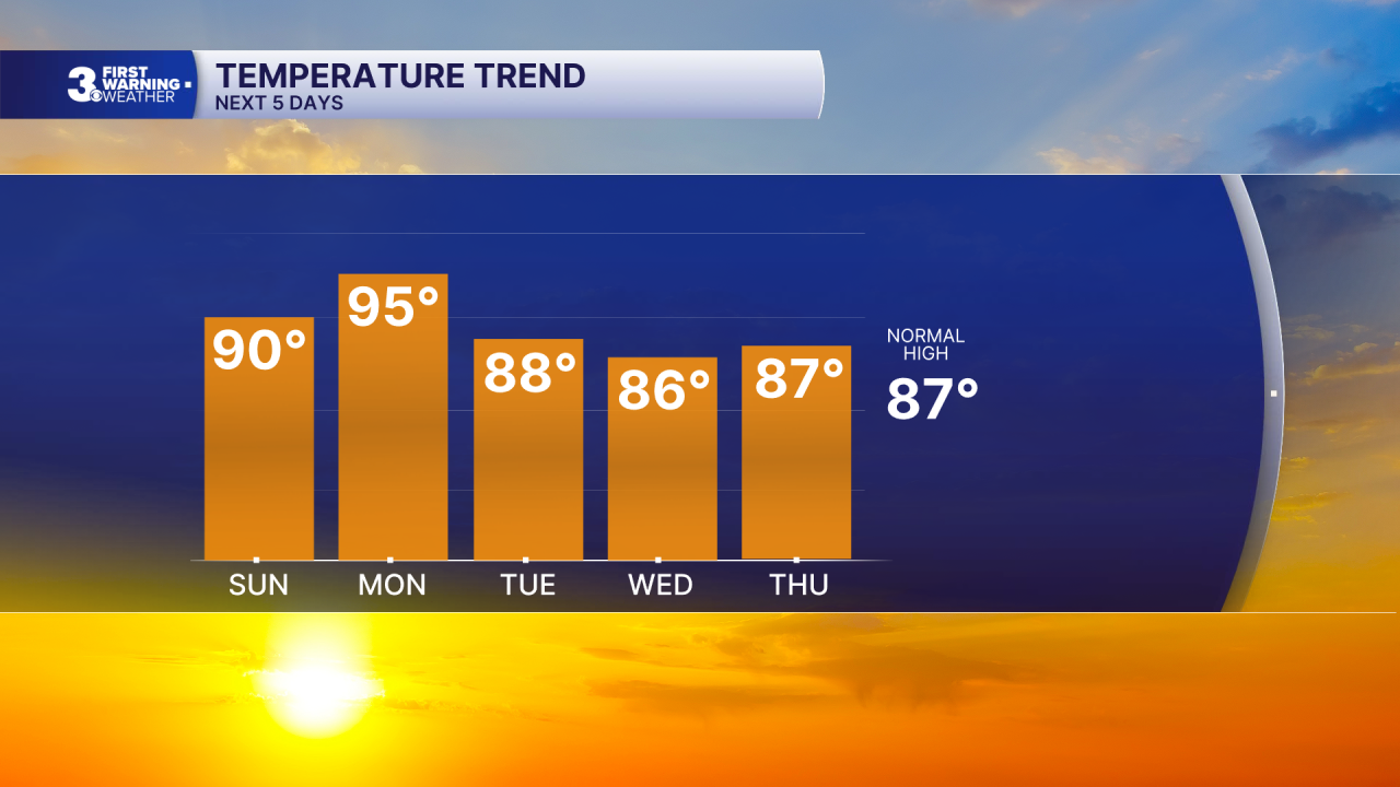
We will take a step warmer Sunday with highs near 90, about 5 degrees warmer than today. Look for mostly sunny to partly cloudy skies.

Highs will warm to the mid 90s on Monday with an afternoon heat index to 100+. Expect partly cloudy skies during with day with a round of showers and storms moving in later Monday to Tuesday with a cold front. Strong to severe thunderstorms are possible.

Highs will drop to near normal in the mid to upper 80s through midweek, then warm back to near 90 to end the week.
Tonight: A Few Clouds. Lows near 70. Winds: N 5-10
Tomorrow: A Few Clouds. Highs near 90. Winds: NW/NE 5-10
Weather & Health
Pollen: Low-Moderate (Grasses)
UV Index: 10 (Extreme)
Air Quality: Good (Code Green)
Mosquitoes: Extreme
Tropical Update
No tropical activity at this time
Weather updates on social media:
Facebook: MylesHendersonWTKR
Instagram: @MylesHendersonWTKR
