


Meteorologist Myles Henderson’s First Warning Forecast
Cooler and less humid Sunday. Cooling to the 70s again next week. Rain returns for midweek.
Highs will drop to the mid 80s today with lower humidity. We will see a nice mix of sun and clouds. It will still be breezy with a NW wind at 10 to 15 and gusts 20 to 25 mph.

A nice start to the work week on Monday. Highs will drop to the low 80s with mostly sunny skies.
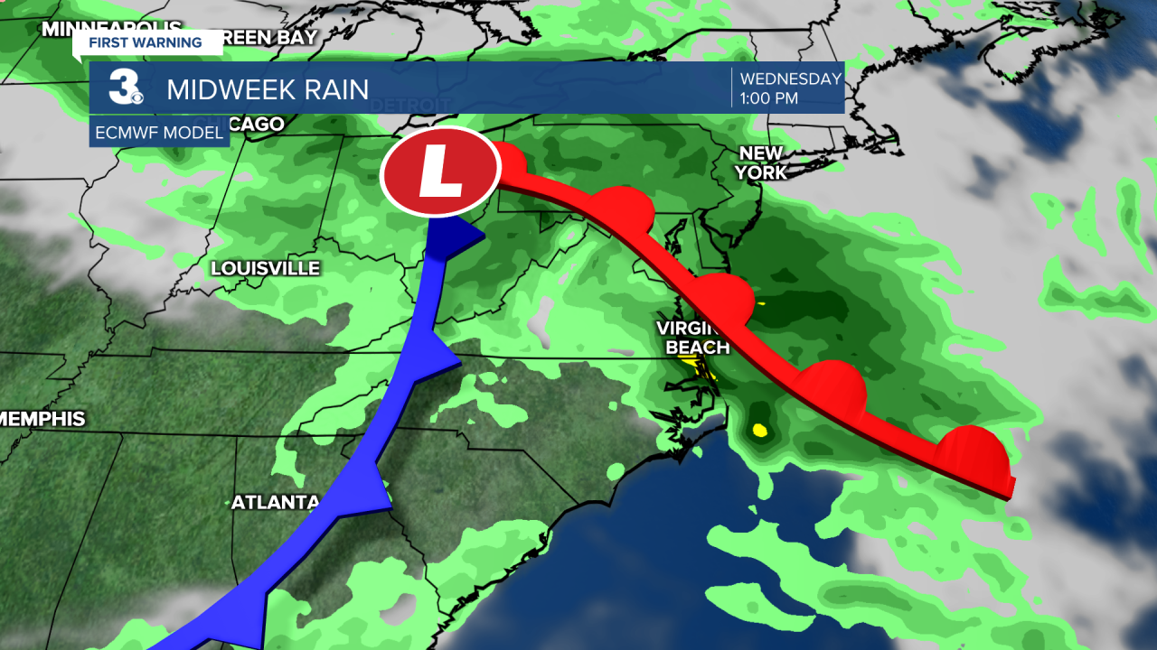
Temperatures will fall to the mid 70s for midweek, a step below normal for this time of year. Showers and storms return late Tuesday, through Wednesday, and into Thursday.
Today: Partly Cloudy, Breezy. Highs in the mid 80s. Winds: NW 10-15
Tonight: A Few Clouds. Lows in the mid 60s. Winds: NW 5-15
Tomorrow: Mostly Sunny. Highs in the low 80s. Winds: NW 5-15
Weather & Health
Pollen: Medium-High (Grasses, Trees)
UV Index: 6 (Moderate)
Air Quality: Good (Code Green)
Mosquitoes: Very High
Weather updates on social media:
Facebook: MylesHendersonWTKR
Instagram: @MylesHendersonWTKR
