


Meteorologist Myles Henderson’s First Warning Forecast
A break from the heat to start the work week. Building heat and humidity through the week. Several days in the 90s ahead.
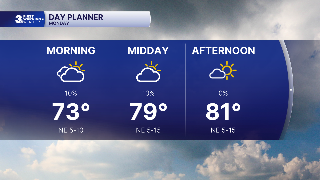
Not as hot but still humid today. Highs will only reach the low 80s today, but it will still be muggy. We will see leftover clouds this morning with more sunshine by the afternoon.
Temperatures will gradually warm through the work week. Expect mostly sunny skies tomorrow with highs in the mid 80s. Highs will reach the low 90s on Wednesday, mid 90s Thursday, and upper 90s Friday.

With the building heat and humidity, afternoon heat indices will reach the triple digits several days in a row. The heat index could reach 110 by Friday.
The extreme heat and humidity continue for the holiday weekend. Expect mostly sunny to partly cloudy skies with highs in the mid to upper 90s.
Today: Clearing Skies. Highs in the low 80s. Winds: NE 5-15
Tonight: Mainly Clear. Lows near 70. Winds: NE 5-10
Tomorrow: Mostly Sunny. Highs in the mid 80s. Winds: E 5-10
Weather & Health
Pollen: Low-Medium (Grasses)
UV Index: 9 (Very High)
Air Quality: Moderate (Code Yellow)
Mosquitoes: Extreme
Tropical Update
A broad area of low pressure is forecast to form along the front offshore of the southeastern coast of the United States in the next day or two. Gradual development is possible while the system drifts south and then west before environmental conditions become less conducive later this week.
* Formation chance through 48 hours: Low (10%)
* Formation chance through 7 days: Low (10%)

Weather updates on social media:
Facebook: MylesHendersonWTKR
Instagram: @MylesHendersonWTKR
