

Derrah Getter's First Warning Forecast
As we end the weekend on a sunny note, all eyes are on where Hurricane Erin will turn next week.

Sunday will be spectacular. We'll see plenty of sunshine with highs in the mid to upper 80s. Rain chances will be slim to none as most locations will remain dry. There is a moderate rip current risk in effect at all area beaches.
Mild conditions with spotty shower and storm chances hold through next week. Rough coastal conditions will be aroused by Hurricane Erin as it travels off the Atlantic coast.

Hurricane Erin Update
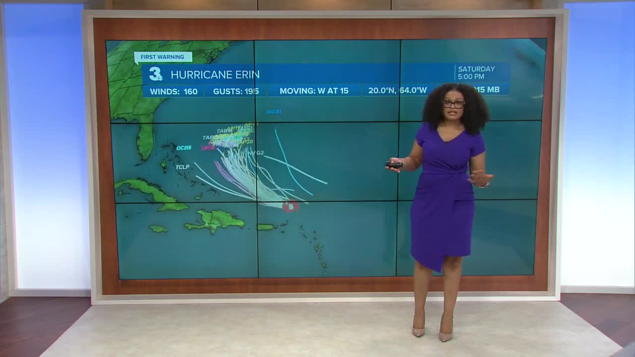
Erin underwent rapid intensification and became a category 5 storm overnight. With winds sustained at 140 mph the storm is undergoing an eyewall replacement cycle. This means Erin has potentially reached maximum strength and is temporarily weaker as it begins slowing down and a new, larger eye begins to form.

Believe it or not, Erin is considered somewhat compact. Models are in strong agreement that the storm will grow in size over the next couple of days resulting in rough coastal conditions.

Most models are still in agreement that an approaching cold front will keep Erin away from land and push it out to sea.

Let's connect on social media!
Forecaster Derrah Getter:
For weather updates on Facebook: HERE
For weather updates on X: HERE
Follow me on Instagram: HERE
Check out the Interactive Radar on WTKR.com: Interactive Radar
