




Meteorologist Myles Henderson’s First Warning Forecast
Building clouds to end the week. Rain from Hurricane Isaias this weekend.
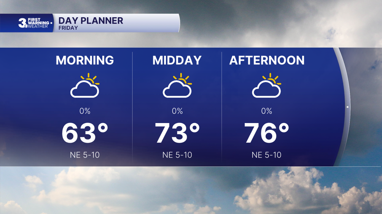
Highs will drop back to the mid 70s today, near normal for this time of year. Expect a mix of clouds throughout the day with light wind.
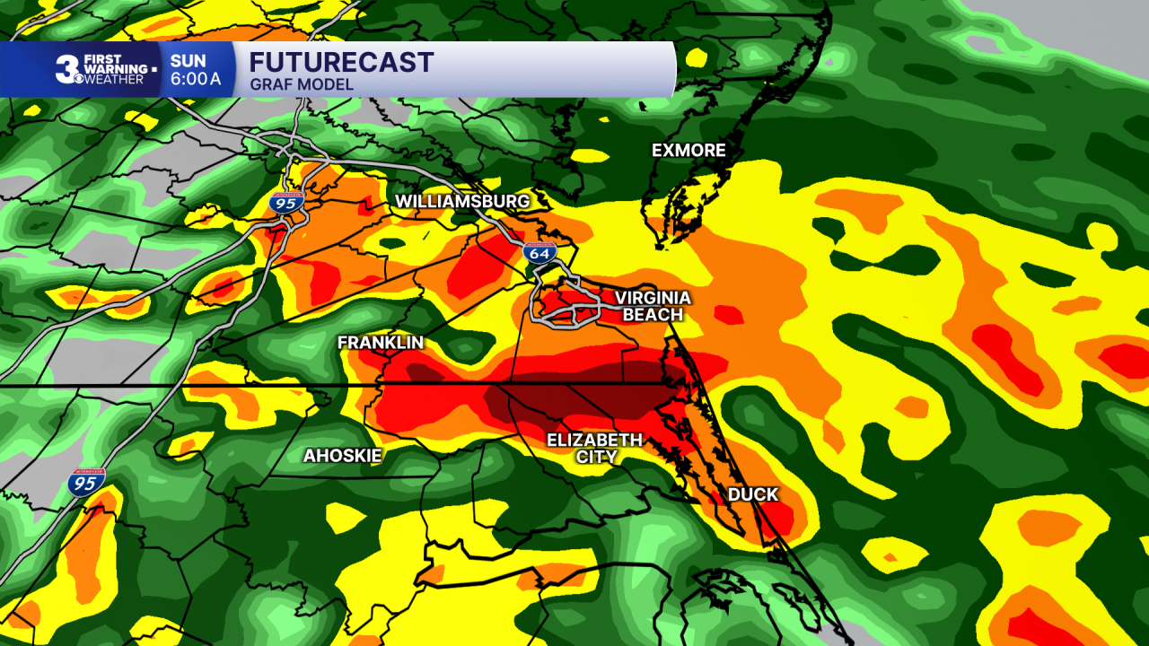
When it comes to our weekend forecast, all eyes are focused to the south. Hurricane Isaias is forecast to make landfall near Pensacola, Florida tonight. Even though the worst of the storm will be along the Gulf Coast, it will spread rainfall across the Southeast to Mid-Atlantic this weekend.
Expect mostly cloudy skies on Saturday with highs in the low to mid 70s. Rain will build in Saturday night, but most of the day looks dry. Winds will start to pick up Saturday, east at 10 to 15 mph.
Widespread rain will move in Sunday with a stray storm possible. Most of the region will see 1” to 3” of rainfall and localized flooding is possible. Wind will pick up Sunday, mainly SE at 10 to 20 with gusts to 30 mph. Highs will return to the mid 70s.
Today: Mix of Clouds. Highs in the mid 70s. Winds: NE 5-10
Tonight: Mostly Cloudy. Lows in the mid 60s. Winds: E 5-10
Tomorrow: Mostly Cloudy, Breezy. Highs in the mid 70s. Winds: E 10-15
Weather & Health
Pollen: Low-Medium (Ragweed)
UV Index: 4 (Medium)
Air Quality: Good (Code Green)
Mosquitoes: High
Tropical Update
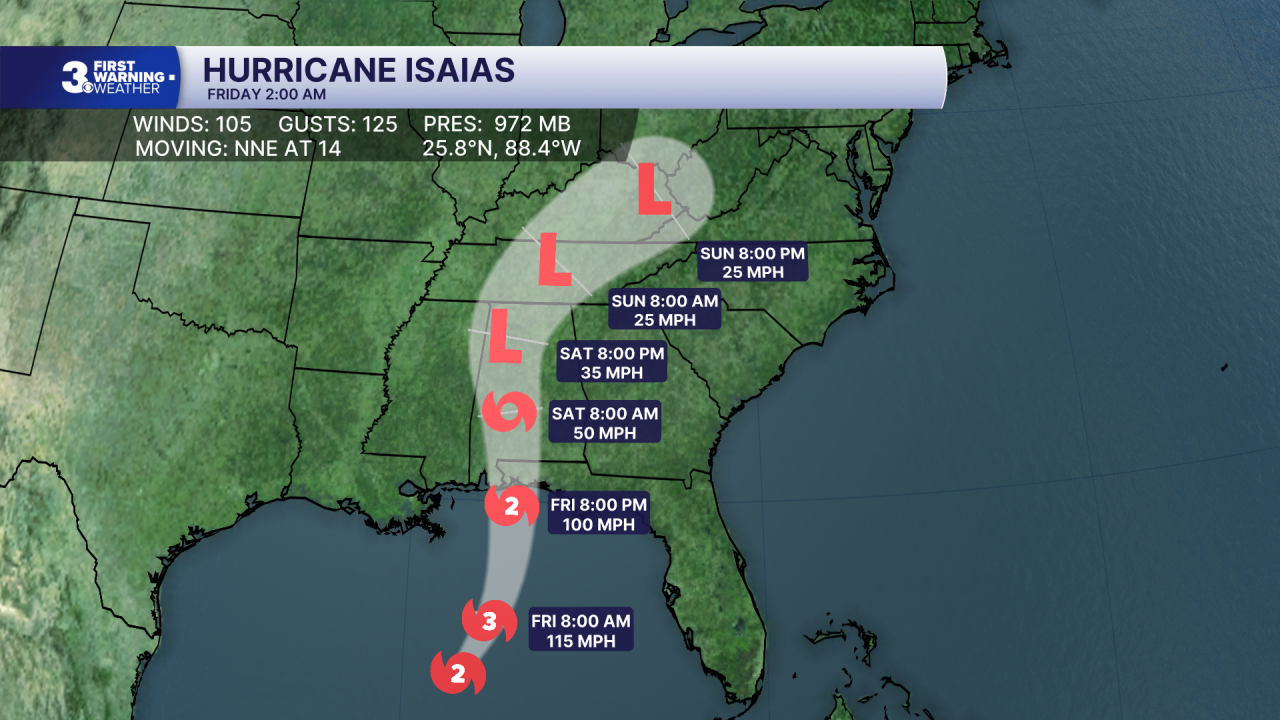
Hurricane Isaias continues to intensify over the Gulf. On the forecast track, Isaias is expected to approach the U.S. northern Gulf Coast later today and make landfall near Pensacola, Florida tonight or early Saturday.
Maximum sustained winds remain near 105 mph with higher gusts. Isaias could briefly become a major hurricane later today. Although some weakening is forecast thereafter, Isaias will remain a dangerous hurricane as it approaches the Gulf Coast tonight.
Weather updates on social media:
Facebook: MylesHendersonWTKR
Instagram: @MylesHendersonWTKR
