

Derrah Getter's First Warning Forecast
This evening, showers move out and cooler temperatures move in.
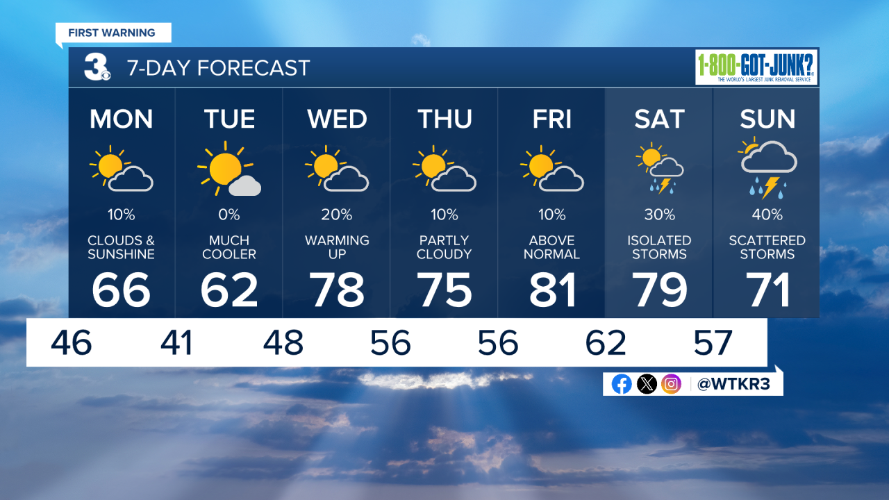
Tonight, lows fall into the 40s. The gusty conditions stick around. Some of us could wake up to wind chill values in the upper 30s Monday morning.

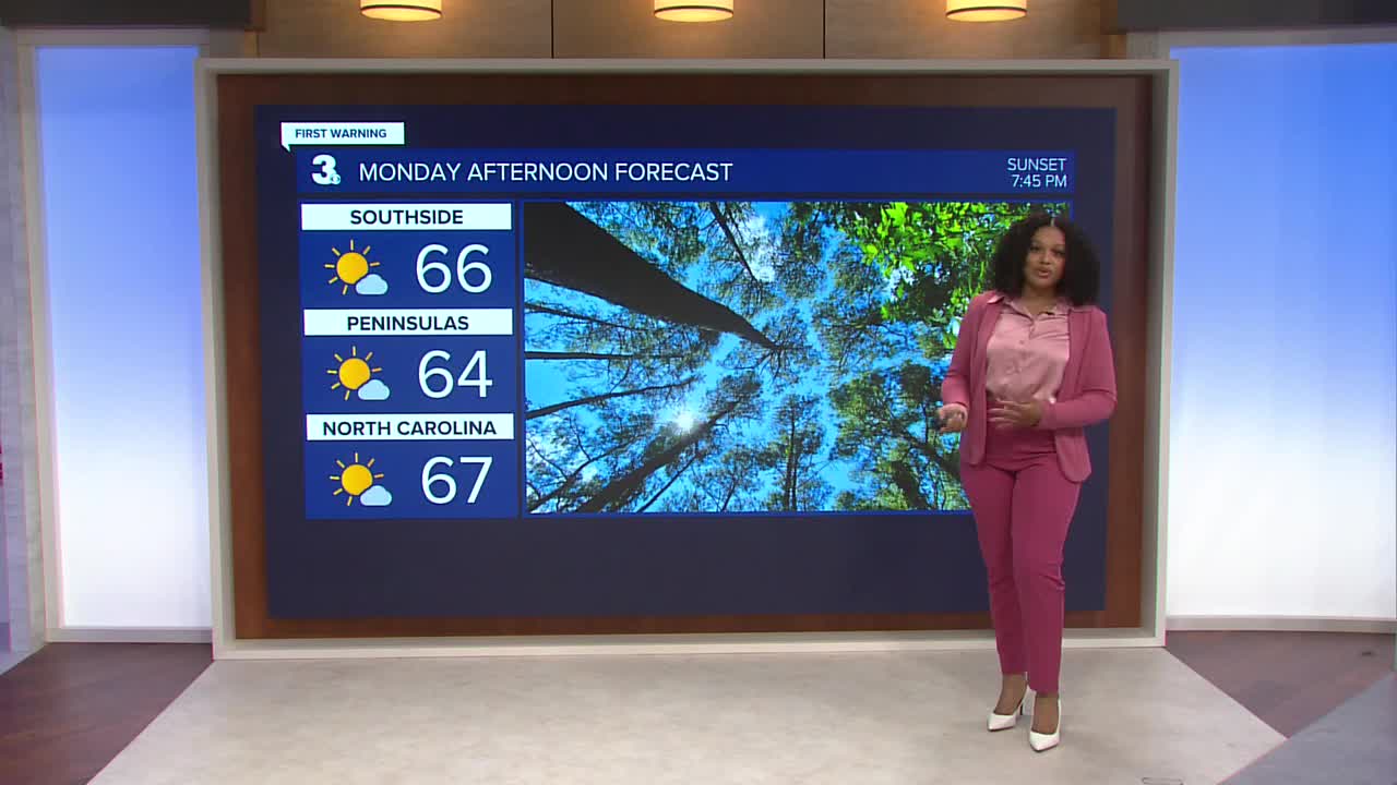
A dry cold front approaches Monday. A few spotty showers will be possible in the morning with clearing skies in the afternoon. Highs will be in the low to mid 60s.

Tuesday will be our coolest day of the week with highs in the upper 50s and low 60s.
Warmer temperatures and spotty showers return during the middle of the week. Highs will reach the 80s by Friday.
Next weekend, we’re tracking another round of scattered showers and storms.
Let's connect on social media!
Forecaster Derrah Getter:
For weather updates on Facebook: HERE
For weather updates on X: HERE
Follow me on Instagram: HERE
Check out the Interactive Radar on WTKR.com: Interactive Radar
