

First Warning Forecast:
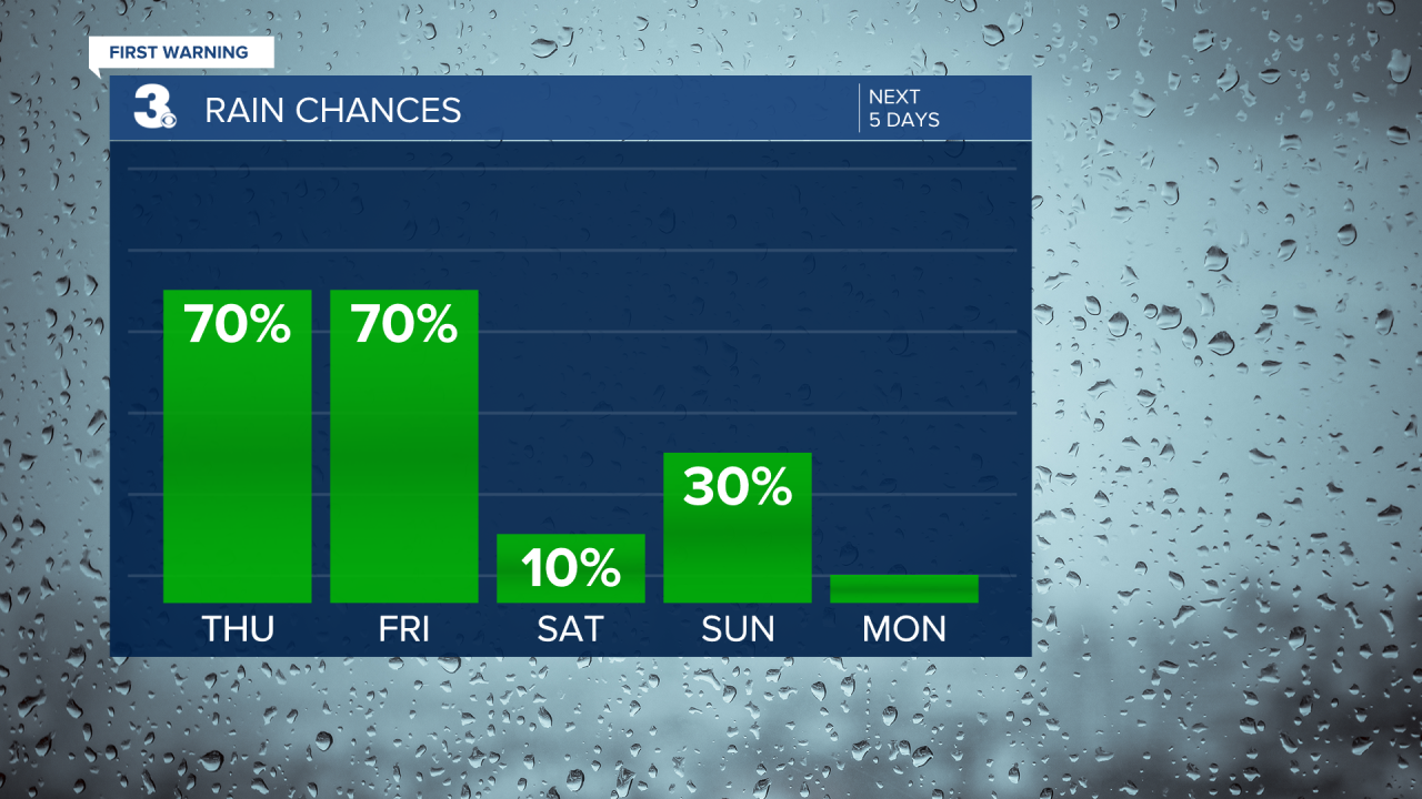
Tracking Zeta as it brings wind, rain and possible severe weather to the area this afternoon. Another round of showers overnight into Friday morning.
Today, damaging winds along with soaking rain and strong to severe thunderstorms are all possible impacts. In addition, some areas along the North Carolina coast may deal with minor coastal flooding this Thursday afternoon. A Wind Advisory is effect through the evening hours due to the likelihood of 40 mph wind gusts.
Severe Threat is a level one for damaging winds and an isolated tornado. Outside of any storm, expect windy conditions to continue for Friday with persistent gusts upwards of 35 mph. This could lead to downed tree limbs and power outages.
Temperature wise, near 80 for Thursday then quickly falling into the 60s Friday and even down into the 50s for highs on Saturday.
Dry for Halloween this weekend, but breezy and much cooler. Sunday will be the pick of the weekend with highs in the mid 60s with a few late-day showers from the cold front. Behind the cold front, we'll see sharply cooler, but sunny weather for Monday and Tuesday (Election Day).
